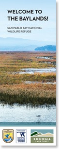
SEARS POINT WETLAND RESTORATION
A Bold Undertaking
The Sears Point Tidal Wetland Restoration Project is one of Sonoma Land Trust’s boldest undertakings. More than a decade of planning and fundraising followed the original property acquisition. To ensure we incorporated the best and most innovative design elements, we hired some of the Bay Area’s most accomplished and experienced scientists, engineers and modelers to develop a preliminary project design. This design was later refined by Ducks Unlimited, our partner and consultant, and we worked together through all subsequent stages, including permitting, construction and, ultimately, the breach.
Successful tidal marsh restoration depends on many things, but among the most important physical processes is adequate tidal exchange between the bay and the project site. The tides bring the water, the sediment, the seeds, the nutrients, the wildlife and, ultimately, are the driver of tidal channel formation.
Wetland Restoration Project
On October 25, 2015, several hundred people bore witness as the map of San Francisco Bay was changed. A large excavator took the final scoops from a 150-year-old levee to allow the tides to pour back into nearly 1,000 acres of diked agricultural baylands at Sears Point Ranch.
Marsh Mounds
Development of mudflats and the tidal marsh relies on sediment carried in with the tides. The land has subsided six feet on average since it was diked nearly 150 years ago, so until we get six feet of mud across nearly 1,000 acres, the site will be under water — with no marsh. So the sediment has to come in with the tides and be left behind to accumulate over time. We added special features to facilitate this process, like the 500 marsh mounds. These randomly located mounds of dirt serve as barriers to waves caused by wind and help to promote sediment retention. Based on early monitoring, they are doing their job well!
Because we needed to protect the SMART railroad, Highway 37 and our neighbors, we built a new levee, one that uses modern thinking to provide not only flood protection but also habitat. Unlike traditional steep-sided levees without vegetation, ours has a gently sloping bay side, which, over time, will be covered with native plants to provide habitat for marsh wildlife during periods of high water when the marsh is flooded. Endangered species, like the salt marsh harvest mouse and Ridgway’s rail, are among the species needing such shelter.
So from where did all the soil come to build this levee? We dug nearly six miles of channels in the restoration area before it was flooded and then used that soil to build the levee.
Monitoring
We are working with scientists from the San Francisco Bay National Estuarine Research Reserve, San Francisco State University and several unaffiliated to conduct a variety of monitoring studies aimed at understanding how the tidal marsh restoration is progressing. Among the indicators we are looking at are sediment accretion, vegetation, tidal channel formation, bird use and more. Monitoring will span 15 years, which began in 2015, and results will be posted at various intervals. The most recent report covers the 2015-2020.
Executive Summary (155 KB)
Sears Point Restoration Project Year 5 Monitoring Report (36 MB)
Appendix A – Air Photos (23 MB)
Appendix B – Field Photo Monitoring (24 MB)
Appendix C – LiDAR Data Reports (8 MB)
Appendix D – Bathymetric Survey Results (3 MB)
Appendix E – Levee Erosion Data (13 MB)
Appendix F – North Levee Cordgrass Planting (12 MB)
Appendix G – Northern Ecotone Levee Planting (12 MB)
Appendix H – Bird Monitoring Results (1 MB)
Appendix I – Fish Survey Report (3 MB)
Appendix J – Invasive Species Control Report (1 MB)
Adaptive Management
In ecological settings, what we call adaptive management is simply a cycle of “manage-monitor-adjust-repeat.” Five years of monitoring at the Sears Point wetlands has revealed many positive trends — but also shoreline erosion. Common to many restored and mature marshes, shoreline erosion is a challenge that will get worse with rising seas, so solutions are needed. While erosion is often treated with riprap (rock boulders), that approach is static and without ecological value. In 2021, Sonoma Land Trust implemented a nature-based solution employing strategic placement of logs, soil, plants and gravel to shift ecological processes back to an accreting rather than eroding shoreline. The process is more thoroughly explained in this five-minute video.
Below are links to the Sears Point Levee Adaptive Management Project Report and its appendices. In addition, a link is provided to our monitoring plan which will help us understand how the adaptative management is working.
Sears Point Levee Adaptive Management Project Report (13 MB)
Appendix A – Baseline UAV Survey Report (6 MB)
Appendix B – As-Built UAV Survey Report (6 MB)
Appendix C – Baseline and As-Built Imagery (29 MB)
Appendix D – Baseline and As-Built Topography (28 MB)
Appendix E – As-Built Plan Set (41 MB)
Appendix F – Baseline Topographic Transects Survey Report (4 MB)
Appendix G – As-Built Topographic Transects Survey Report (2 MB)
Appendix H – As-Built Port of Sonoma Bay Mud Borrow Area Topography (6 MB)
Appendix I – Annotated Construction Photographs (6 MB)
Appendix J – Before-After Photographs (14 MB)
Appendix K – Construction Certification (513 KB)
Appendix L – Cells 6 and 7 Levee Transects (1 MB)
Sears Point Levee Adaptive Management Monitoring Plan (10 MB)
Public Access
Among our proudest achievements was being able to invite the public to the site to witness the evolution of Sears Point as it transitions back to tidal marsh. To this end, we constructed a 2.5-mile segment of the San Francisco Bay Trail that is open every day from sunrise to sunset. In total, there are five miles of walking trails here (10 miles out and back) — one of the best kept secrets on the bay! And if you are a kayaker, getting out on the water is a wonderful way to experience the site up close. Sonoma Land Trust transferred the site to our partners at the San Pablo Bay National Wildlife Refuge in 2015 as they are experienced wetlands managers, and manage public recreation and access throughout San Pablo Bay. Be sure to experience this beautiful and remarkable landscape for yourself and watch the tidal marsh grow and fill in over the next 10−15 years.