
Sonoma County Trail Maps & Hiking Guides
Find your path and get out on the land
Step outside and enjoy the many benefits of nature—fresh air, exercise, and peace of mind. Find your path and get started today with our trail maps and hiking guides.
Maps
Explore our maps
No matter what your skill level or interest, we have maps to help you navigate our county’s lands with confidence.
To download one of our detailed maps of the Baylands, the Sonoma Coast, the Santa Rosa Southeast Greenway, and several more of our protected spaces, please fill out the form below.
*Required
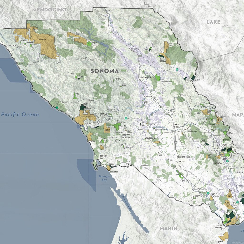
Sonoma Protected Lands Map
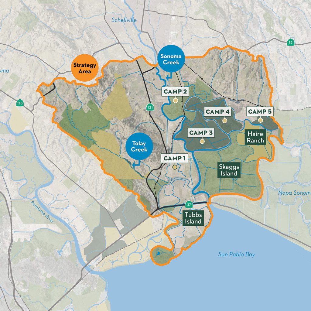
Sonoma Baylands Strategy Map

Santa Rosa Southeast Greenway

Critical Linkages
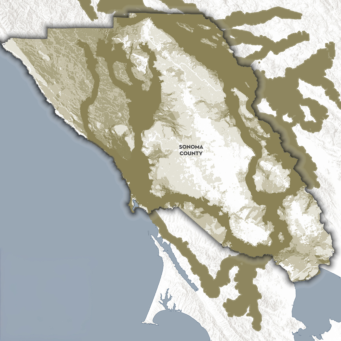
Wildlife Movement in Sonoma County
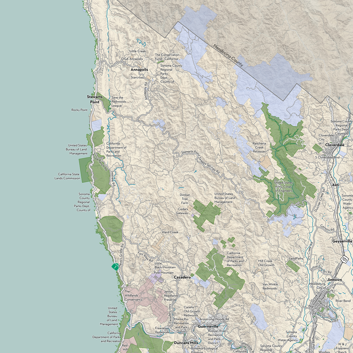
Sonoma Coast Protected Lands
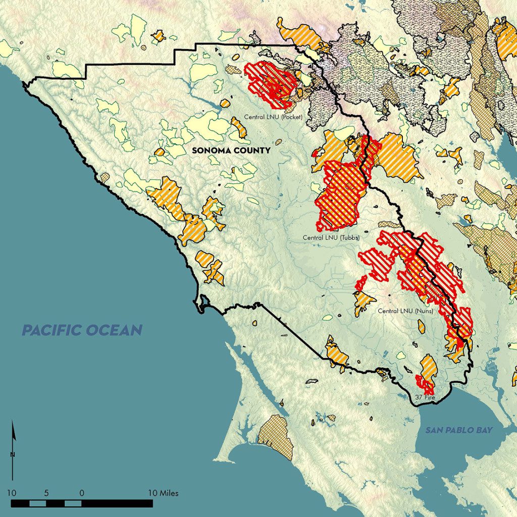
Sonoma Fire History
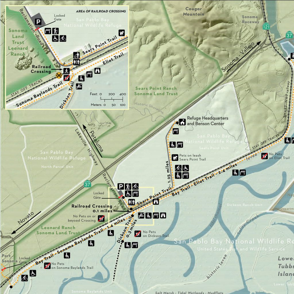
Sears Point Trail at San Pablo Bay National Wildlife Refuge
Maps
Thank you for your interest in one of our maps and/or guides! We’re excited to help you get out and explore Sonoma County’s incredible biodiverse landscapes.
Please click on an image to download.
Sonoma Protected Lands Map
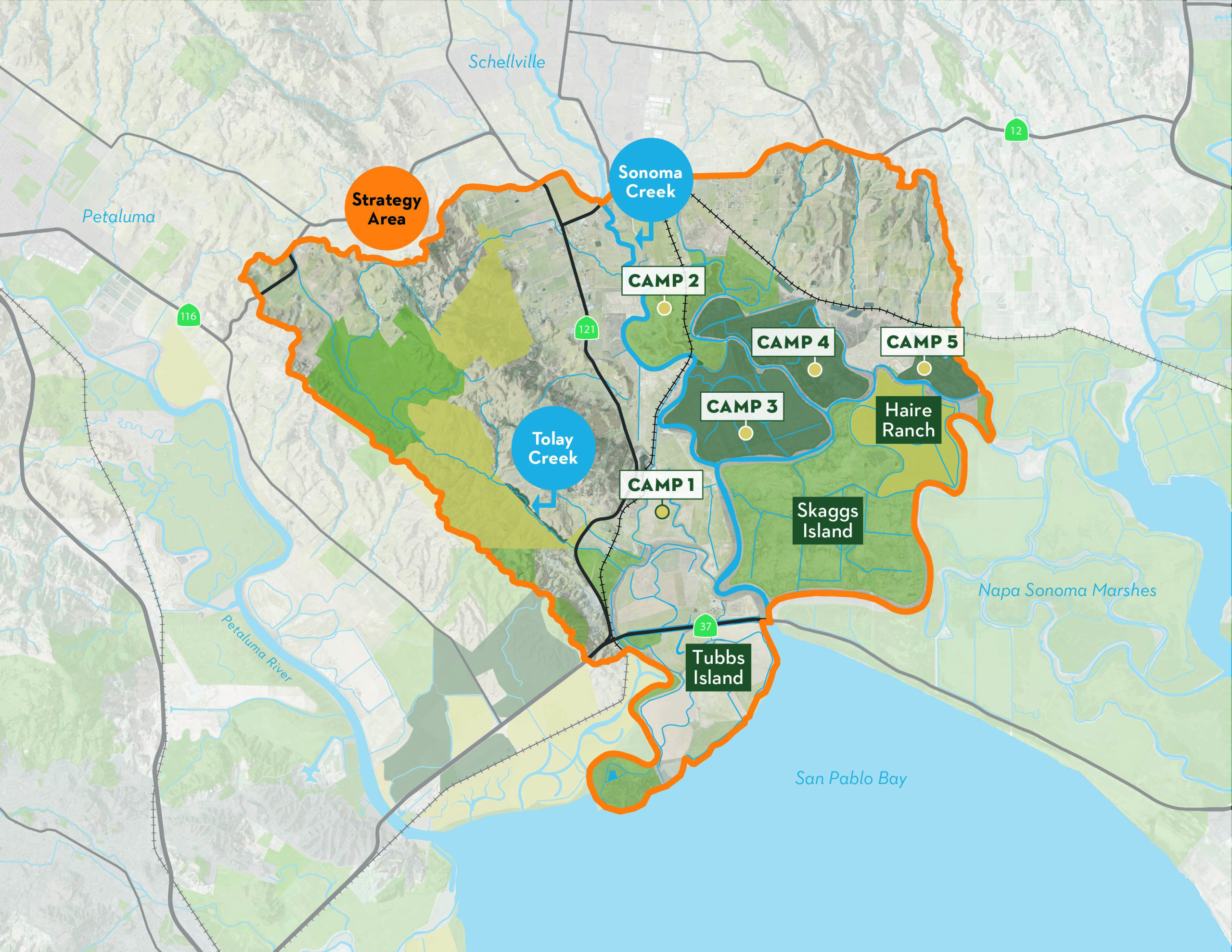
Sonoma Baylands Strategy Map
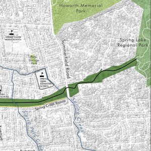
Santa Rosa Southeast Greenway

Critical Linkages
Wildlife Movement in Sonoma County
Sonoma Coast Protected Lands

Sonoma Fire History
Sears Point Trail at San Pablo Bay National Wildlife Refuge
Guides
Download one of our helpful guides
Whether you’re a wildflower fanatic or just want to try a new adventure, our guides have you covered. To download one and get the most out of your time with nature, please fill out the form below.
*Required

Did you know Sonoma County is home to more than 1,000 native wildflower species? Our guide makes it easy to spot some of the most common blooms and details when they appear.

Sonoma County has an abundance of natural spaces to enjoy. This guide includes hiking information for a few of our favorite protected lands, including Pole Mountain, Sonoma Developmental Center, and San Pablo Bay National Wildlife Refuge.

Serving as the southern gateway to Sonoma County, The Baylands are dynamic ecosystems of mudflats and marshes, hosting a rich and diverse wildlife population. Our Baylands of Tomorrow Guide takes you on a journey through this landscape’s past, present, and future, and shares ways you can help restore this thriving buffer that absorbs rising seas and supports resilient habitats.
Like the land and waterways of Sonoma County, cocktails are remarkably diverse and incredibly adaptive. Get your shaker ready—our carefully crafted cocktails are inspired by the regions and places we protect and restore. Enjoy a tasty Baylands Breeze or a refreshing Glen Oaks Grappa. Cheers!
Guides
Thank you for your interest in one of our maps and/or guides! We’re excited to help you get out and explore Sonoma County’s incredible biodiverse landscapes.
Please click on an image to download.
Did you know Sonoma County is home to more than 1,000 native wildflower species? Our guide makes it easy to spot some of the most common blooms and details when they appear.

Sonoma County has an abundance of natural spaces to enjoy. This guide includes hiking information for a few of our favorite protected lands, including Pole Mountain, Sonoma Developmental Center, and San Pablo Bay National Wildlife Refuge.
Serving as the southern gateway to Sonoma County, The Baylands are dynamic ecosystems of mudflats and marshes, hosting a rich and diverse wildlife population. Our Baylands of Tomorrow Guide takes you on a journey through this landscape’s past, present, and future, and shares ways you can help restore this thriving buffer that absorbs rising seas and supports resilient habitats.
Like the land and waterways of Sonoma County, cocktails are remarkably diverse and incredibly adaptive. Get your shaker ready—our carefully crafted cocktails are inspired by the regions and places we protect and restore. Enjoy a tasty Baylands Breeze or a refreshing Glen Oaks Grappa. Cheers!