WHERE WE WORK
Remarkable Diversity
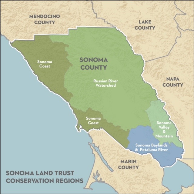
Sonoma County is the largest of the nine Bay Area counties and its landscapes and communities are remarkably diverse, with redwood forests, a major river and dramatic coast, the broad Santa Rosa plain, the craggy Mayacamas Mountains and Sonoma Mountain framing Sonoma Valley, and wide-open tidal marshes along the bay. Along with vineyards, orchards, ranches and farmland, these natural landscapes create a mosaic that define a unique sense of place for our communities. At Sonoma Land Trust, we approach our work regionally — developing and implementing conservation strategies that are tailored to the unique qualities of the Sonoma Coast, Russian River watershed, Sonoma Valley and Mountains, and the Sonoma Baylands.
Sonoma Valley/Sonoma Mountain Region
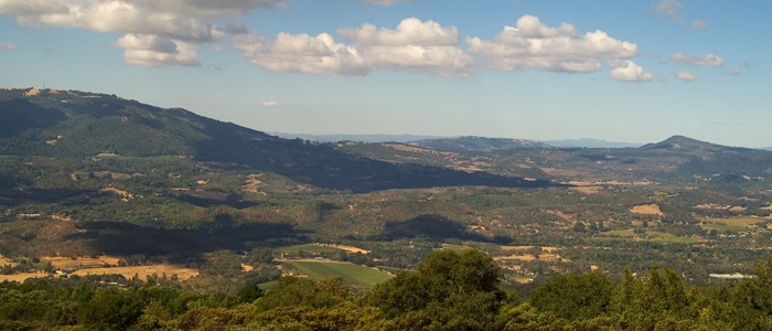
The Sonoma Valley/Sonoma Mountain region is recognized as a landscape of supreme natural beauty and land use diversity. This narrow, 17-mile-long valley is framed by several mountain ranges and includes over 130,000 acres of wildlands, farms and ranches, vineyards, and communities that are home to over 40,000 people. The prominent scenic and natural features of the region begin with the distinctive Sonoma Valley itself, an extraordinarily productive agricultural area that was the birthplace of California’s wine industry in the 1850s.
The Sonoma Land Trust got its start in the Sonoma Valley in the mid-1970s when a group of local landowners and citizens grew concerned that the pace of growth and development could have a lasting negative impact on the valley’s rural character and biodiversity. Since that time, we have protected hundreds of acres in the region by managing a network of Land Trust preserves that are critical to wildlife movement, developing conservation agreements with private landowners to link valuable wildlife corridor areas on both sides of the valley, and expanding state and county parks.
Additional resources:
Sonoma Region Conservation Plan
Sonoma Valley Wildlife Corridor Project: Management and Monitoring Strategy
Baylands Region
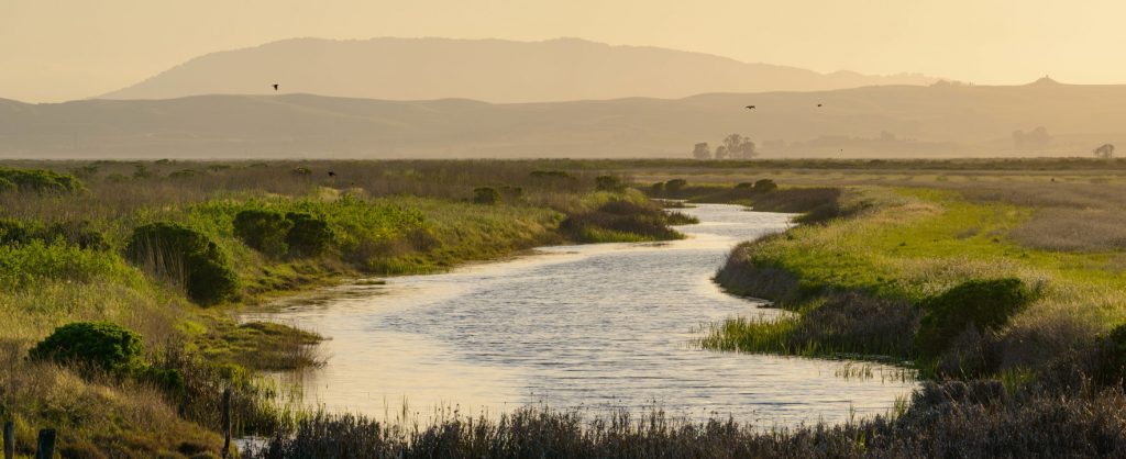
Serving as the southern gateway to Sonoma County, the San Pablo Baylands are unique in their beauty, history and rare potential for conservation. This area, which extends along the San Francisco Bay shoreline from Novato to Vallejo, and inland to Petaluma and Sonoma, was once an expansive mosaic of wetland habitats, including tidal and freshwater marsh and riparian corridors connecting the baylands to the uplands. Fed by the branching estuaries of Novato Creek, Petaluma River, Sonoma Creek and Napa River, the baylands provided habitat to an abundance of species and was home to the Coast Miwok people.
Beginning in the 1800s, the region was diked and drained for agriculture, which supplied crops and livestock to fuel the settlement and development of Sonoma County and beyond. Today, this region is relatively undeveloped except for agriculture. This presents significant opportunities to reestablish the historical connections between the baylands, its tributaries, and the upper Petaluma River, Sonoma Creek and Tolay Creek watersheds. The restoration process began with the acquisition of the Sears Point and Haire Ranches and restoration of their diked agricultural baylands to tidal wetlands, along with Tolay Creek Ranch and the restoration of Tolay Creek.
Sonoma Land Trust and our partners will continue this important work in the region, seeking solutions to address sea level rise, flooding and saltwater intrusion, while providing habitat for threatened and endangered species, restoring fisheries, establishing new recreation opportunities, and preserving ranch and farmland.
Additional resources:
Sonoma Coast Region
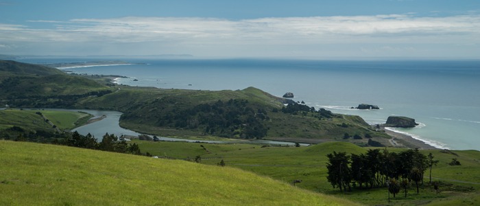
The beauty and biodiversity of the Sonoma Coast is world-renowned: It is a wild and rugged shoreline flanked by marine sanctuaries and dotted with rich estuaries where our rivers meet the sea. The coastline extends from the mouth of the Gualala River at the north down to the Estero Americano at the south. Just inland lies a mosaic of lush redwood and Douglas fir forests, open grasslands, oak woodlands and unique geological formations.
The coast is home to an abundance of native California wildlife species, including coho salmon, steelhead trout, northern spotted owl, bald eagle, mountain lion and black bear. The lands of this region support a rich assemblage of biological diversity and provide a multitude of benefits to our communities, from clean air and clean water to productive forests and coastal grasslands, all interrelated and dependent on each other.
Major threats to the ecological and economic viability of this region include the fragmentation of habitats and parcelization of land into rural estates – along with the risk of catastrophic wildfire due to the hazardous buildup of heavy timber and wildland vegetation in areas of steep topography. A rapidly heating atmosphere has dramatically intensified our vulnerability to these wildfires resulting from more than a century of fire suppression, poor forest management, and development within the wildland-urban interface.
In response, Sonoma Land Trust is using a variety of land protection and stewardship tools to ensure that our iconic coastline and coastal forests remain intact, healthy and sustainable for generations to come. The Land Trust’s coastal preserves are sites of ongoing forest fire fuel-reduction projects intended to reduce the impacts of wildfire, improve the safety of residents and neighbors, and achieve multiple important natural resource benefits. By working with the community, local government agencies, nonprofits and Indigenous tribes, we aim to restore fire to its natural and beneficial ecological role on the landscape while improving community safety.
Additional resources:
Click here to see a video about the Pole Mountain fuel reduction project.
Russian River Watershed Region
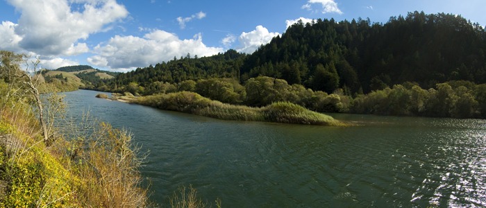
Only a handful of locations around the world are as rich in biodiversity as the landscape through which the Russian River flows, from the headwaters in the Laughlin Mountain Range 15 miles north of Ukiah, to its mouth at the Pacific Ocean near the town of Jenner, 53 miles north of San Francisco. Draining an area of approximately 1,485 square miles, the watershed hosts a diversity of rare and endemic animal and plant species, and provides critical ecosystem services, including purifying water and controlling flooding. The watershed also provides drinking water for more than 600,000 residents.
An array of habitats can be found in the Russian River watershed’s valleys, meadows and mountaintops, including Sonoma County’s iconic oak woodlands and majestic redwoods, mixed evergreen forests, lush willows and alder, serpentine chaparral and grasslands. These diverse habitats support animals that need large, undeveloped areas to roam, such as bear, mountain lion and ringtail cat. The river and its tributary creeks are home to coho and chinook salmon, steelhead, and California’s tiger salamander and red-legged frog.
Sonoma Land Trust is focusing its work on three key elements to enhance resilience in the Russian River watershed. First, the Land Trust is incorporating water resources into its land protection and stewardship activities to ensure sufficient streamflow for the endangered and threatened fish living in the tributaries and main stem of the river. Second, the Land Trust continues to support biodiversity through activities that increase landscape permeability, connectivity and diverse native species composition. Third, the Land Trust is using prescribed fire to enhance forest and grassland health and reduce the risk of catastrophic wildfire.
Additional resources:
Evaluating and Protecting Environmental Water Assets: A Guide for Land Conservation Practitioners
