
Camp 4 Preserve
Property Type
Ecological Preserve
Acreage
1,148.9 acres (declared)
Region
Sonoma Baylands & Petaluma River
Date Protected
2023
Habitat
Sensitive
Access
By Permission Only
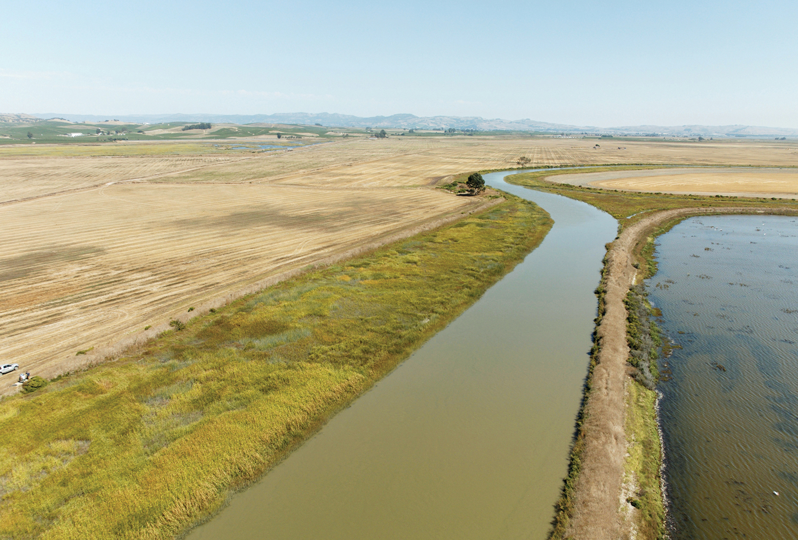
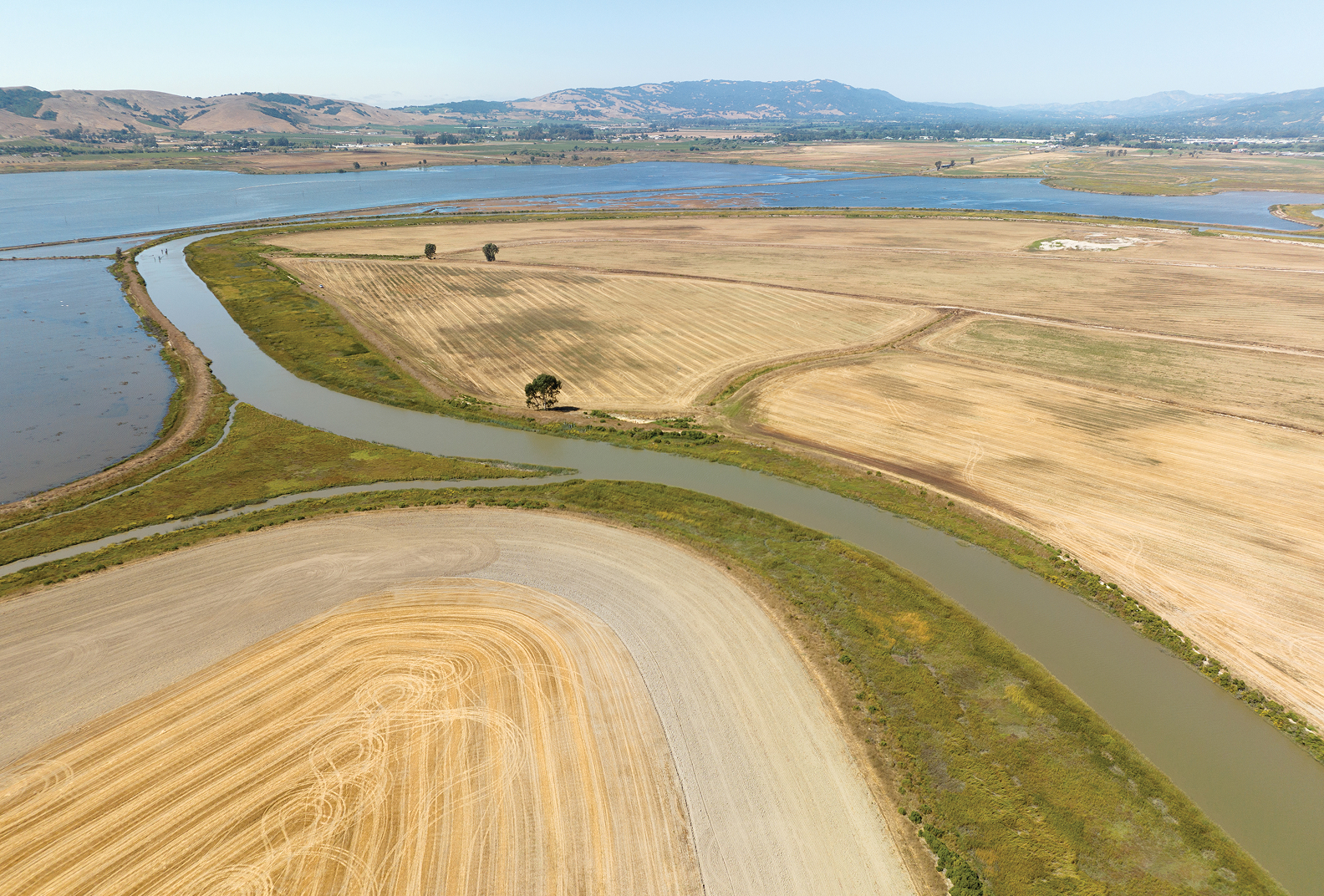
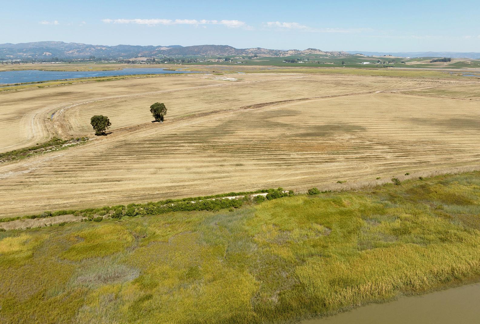
Expanding Tidal Marsh & Adapting to Rising Waters
Restoration and preservation of Camp 4 will provide more than 1,000 acres of land and seven miles of slough for expanded tidal marsh wetlands and a strengthened buffer against sea level rise.
Explore a storymap of our work in the Baylands here
Location
Sonoma Creek Baylands adjacent to the San Pablo Bay National Wildlife Refuge and the Napa-Sonoma Marshes Wildlife Area
Natural Features
The acquisition and restoration of the Camp 4 property offers significant benefits for both the environment and the community:
- Enhanced Habitat Diversity: Restoration of the 1,150-acre wetland habitat enhances San Francisco Bay’s biodiversity, providing a home for a diverse range of plants, fish, birds, and other wildlife.
- Resilience Against Sea Level Rise: The restoration efforts contribute to the community and habitat’s resilience against the impacts of rising sea levels. The project aligns with Sonoma Land Trust’s Adapting to Rising Waters strategy to protect and restore over 10,000 acres of baylands ecosystems.
- Critical Wildlife Populations: The property will serve as a vital habitat for special-status plants, fish, and wildlife, including the endangered Ridgway’s rail and salt marsh harvest mouse. Additionally, it will support hundreds of thousands of waterfowl and shorebirds along the Pacific Flyway, contributing to their conservation.
- Concentration of Waterfowl: The property will become home to more than 30 species of waterfowl, including a significant population of canvasback ducks—one of the largest concentrations in North America—and approximately 50 percent of the Pacific Flyway’s diving duck population.
Acquisition & Stewardship
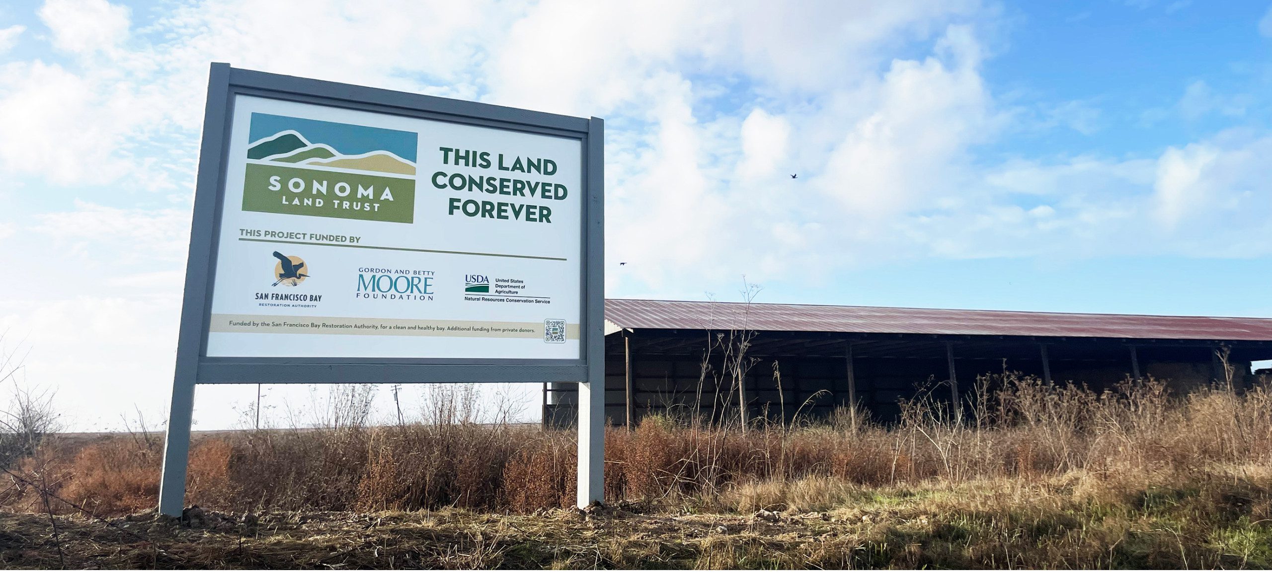
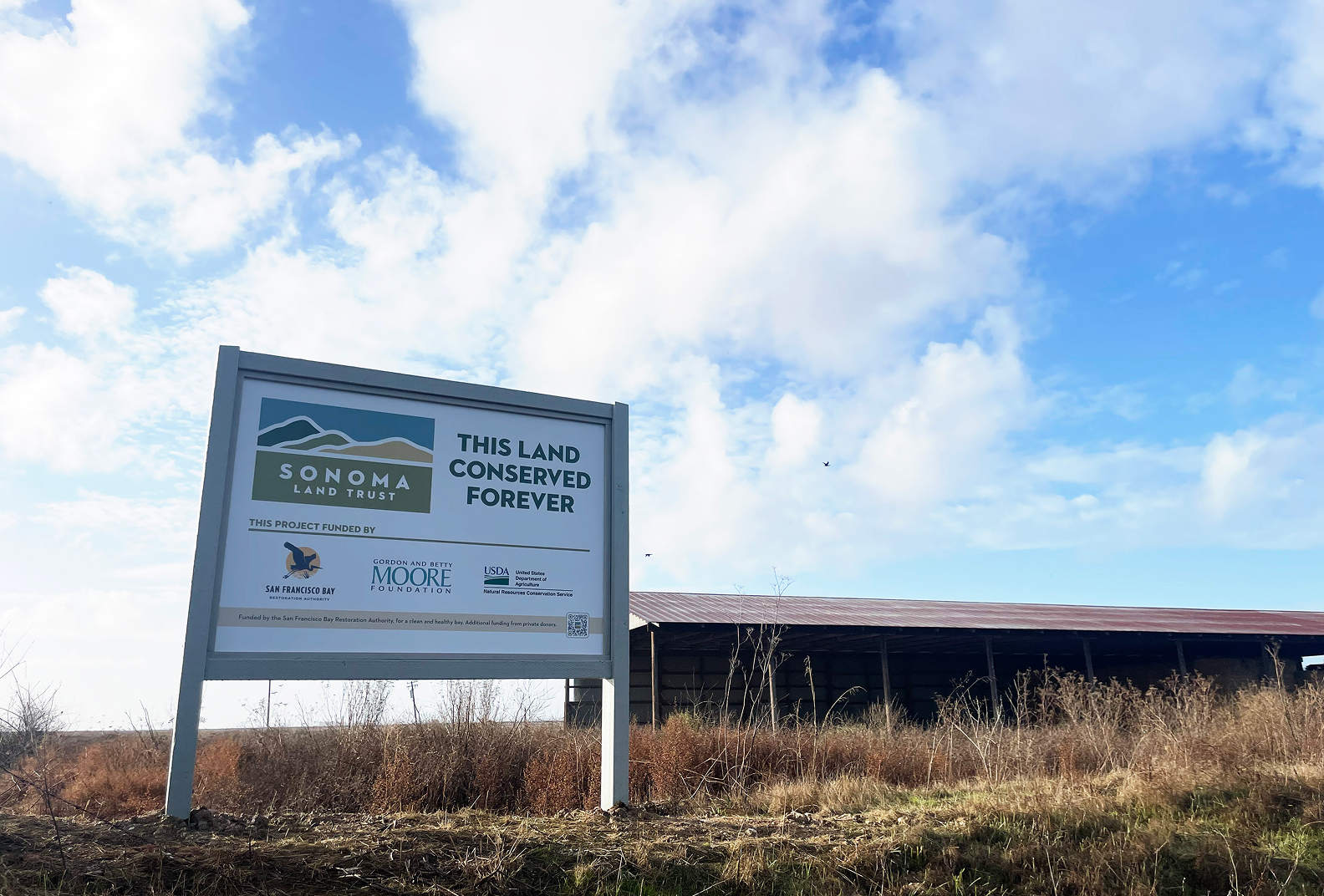
Acquisition: The purchase was made possible through a partnership between Sonoma Land Trust, the Natural Resources Conservation Service, the Gordon and Betty Moore Foundation, and with funding from Measure AA administered by the San Francisco Bay Restoration Authority. The collaboration’s primary goal was to secure the 1,148-acre property through a Wetland Reserve Easement (WRE) purchased by NRCS. We acquired the property’s underlying fee title, subject to the WRE.
Stewardship: Sonoma Land Trust and NRCS will work hand-in-hand to design and implement a comprehensive tidal restoration plan, and we will take on stewardship responsibilities for up to a decade—or until a suitable partner agency assumes ownership.
Access to the property is currently limited due to restrictions that protect natural wetland habitat, and facilitate restoration and management, as we transition from agricultural use.
The Land
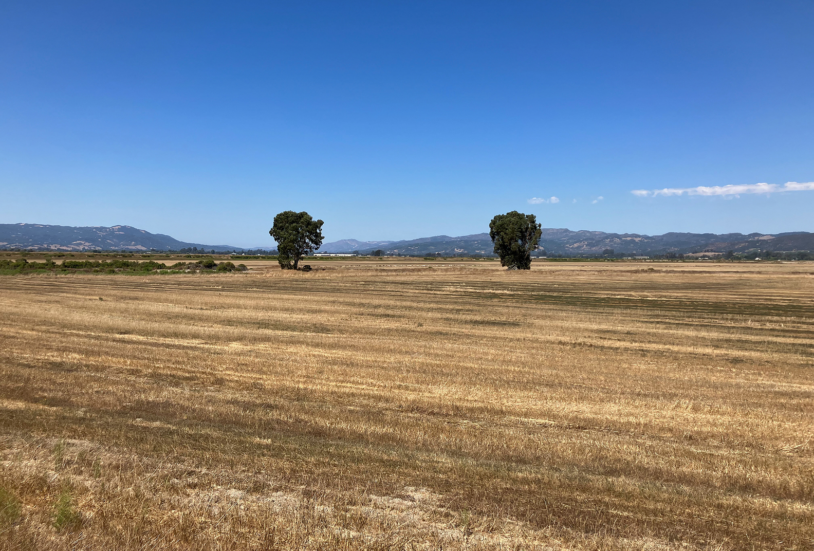
Situated in the heart of the Sonoma Creek Baylands, the property will be restored to tidal marsh wetlands after a century of agricultural use, most recently as an organic hay farm. Camp 4 sits between the San Pablo Bay National Wildlife Refuge and the Napa-Sonoma Marshes Wildlife Area, and is encircled by seven miles of tidal slough channels. This makes it an essential part of the broader wetland network which, when restored, will act as the most critical defense area against rising sea levels in the San Francisco Bay Area.
History
In a report by historian Arthur Dawson, the Camp 4 property was one of many that was drained under the Swamp Land Act of 1850, which provided the initial incentive for individuals to drain lands below the high tide line. It wasn’t until 1890 when this work shifted from human hands to steam-powered dredging machines that it picked up speed.
Around this time, Senator John P. Jones owned 15,000 acres (25 square miles) of Sonoma Valley’s tidelands and drained them for agricultural land. Jones set up six “Camps” with bunkhouses to accommodate the workers on his ranch. As many as two hundred horses were used to work the land and were housed in huge barns. Hay was the most popular crop and was exported to San Francisco to fuel the horse-drawn carriages of that era.
Over time, the converted tidelands dried out, the organic material in them decomposed, and they subsided as much as eight feet in elevation. In addition, these lands were no longer being replenished with sediment from tidal waters and upstream floodwaters from Sonoma Creek. Winter rains watered the dry-farmed oat hay, but the levees prevented the floodwater from spreading across the landscape, creating unintended upstream flooding. The first recorded flooding in the Schellville area occurred shortly after Jones’ dredges completed the first significant levee along Sonoma Creek in 1890.
Sited Resource: Dawson, Arthur. 2016.
Sonoma Baylands Oral History Project report. Developed by Baseline Consulting, Glen Ellen, CA with funding provided by Sonoma Land Trust and Sonoma Resource Conservation District.
30×30
This was Sonoma Land Trust’s second acquisition in 2023 contributing to California’s 30×30 goals, the state’s initiative to conserve 30% of its lands and waters by 2030. As of 2025, approximately 23% of Sonoma County’s lands have been conserved due to the work of land trusts, county and other government agencies, and conservation partners.


