Blog
June 2023 eNews

Bringing cutting-edge climate science to San Pablo Bay
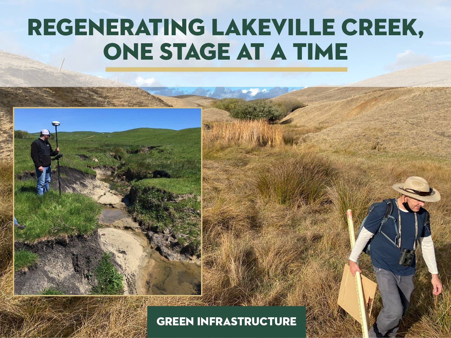
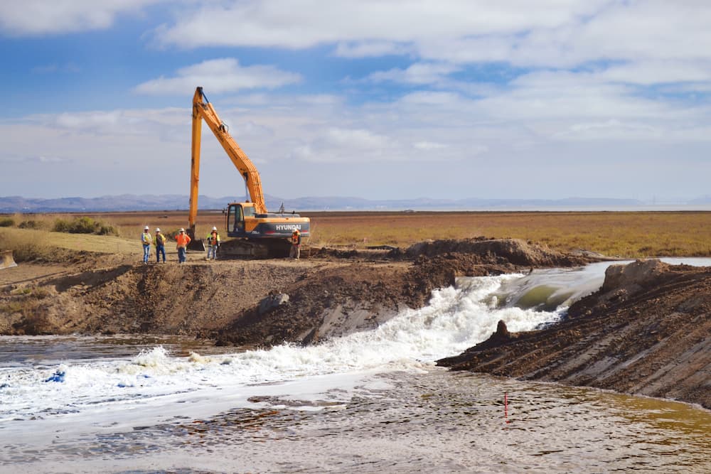
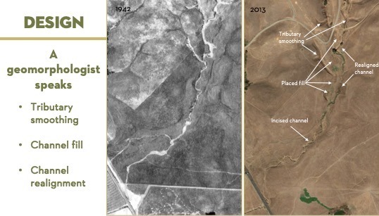
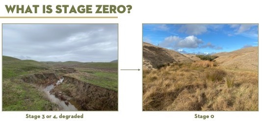
A creek restoration approach called “Stage Zero” is making its Bay Area debut. The restoration project will rehabilitate a 4,200-foot reach of Lakeville Creek, a seasonal tributary to the Petaluma River that links the watershed on the hills of Sears Point Ranch, to the historic water’s edge of the San Pablo Bay. Sonoma Land Trust was awarded $2.2 million from the California Department of Fish and Wildlife (CDFW) for this project and will be initiating the work this summer with Prunuske Chatham, Inc (PCI), ecological consultants.
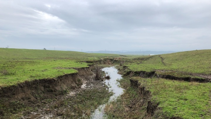
Lakeville Creek is not a creek you might have heard of or can easily spot on a map. It’s a deeply eroded channel that developed over a century of heavy grazing and other land uses on the slopes of the 1,142-acre Sears Point Ranch Preserve. At one time, this seasonal creek valley supported dense wetland vegetation from its upper reaches to the historic bay margin (the boundary used to identify where the bay previously met the land).
Julian Meisler, Sonoma Land Trust’s Baylands program manager, is leading this endeavor and shared his thoughts. “Stream valley restoration projects will become increasingly common in similar settings within California in the coming years because they are effective in restoring the natural processes that make us more resilient to climate change. By returning the missing elements and giving them the time and space to work, the land can capture and store water to help sustain us through droughts, provide moisture for habitats to support wildlife and those habitats become more resilient to wildfires by remaining wetter longer.”
He added, “Back in the early 2000s, Sonoma Land Trust saw an opportunity at the 2,327-acre Sears Point Preserve to positively influence every raindrop from the sky to the bay by protecting and restoring this small watershed. It was purchased specifically for that reason, to restore the grasslands, streams, tidal wetlands, and the processes that connect them. This means connecting habitats for the burrowing owls and silverspot butterflies of the grasslands, red-legged frogs of the freshwater wetlands, and the ridgeway rails and shorebirds of the tidal wetlands.”
This project will build upon Sonoma Land Trust’s two-decades of extensive, landscape-scale wetland restoration program in the baylands using the most successful technology available – nature-based solutions. This project is impressive in scale in that it requires moving nine hundred dump trucks of dirt to fill the eroded channel, adds thirty thousand native plants to create habitat for threatened species, and increases climate resilience that addresses sea level rise, wildfire, and drought.
Transitioning to a thriving ecosystem

Lakeville Creek looks very much like other eroded ditches found throughout Sonoma County and the American west. These eroded waterways are problematic and are drawing the attention of restoration practitioners because they drain water quickly off the land before it can sink into the soil, recharge aquifers, and hydrate habitat that can resist drought in dry seasons. Simply stated, they exacerbate flooding, increase susceptibility to wildfire, and prevent wetland vegetation from developing, leaving no place for the species that rely on them, such as the threatened California red-legged frog. These wetland or riparian ecosystems are incredibly valuable and provide filtered water, carbon sinks, and more importantly, they support a greater variety of biodiversity (plants, fish, birds, etc.) and are home to more threatened and endangered species than any other habitat in California. Restoring our remaining wetlands is a key component to creating a buffer from the worst effects of climate change.
Conceiving of Stage Zero took time but is quickly being adopted
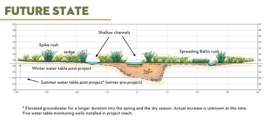
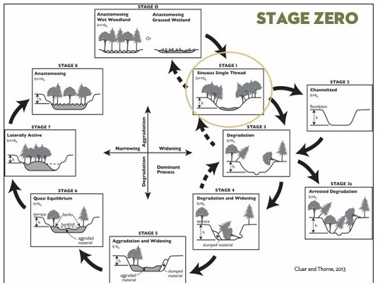
It may come as no surprise to learn that this new concept for creek restoration was co-authored by a NOAA scientist who lives right here in Sonoma County. Brian Cluer is a scientist who has studied the degraded states of streams, creeks, floodplains, and wetlands here in our county and in the Pacific Northwest. In an influential paper published over a decade ago with Colin Thorne, an environmental scientist from the United Kingdom, Brian argued that the eight stages of creek evolution were not comprehensive enough and lacked the preliminary state present in some streams, something that is now referred to as “Stage Zero.” They explain in the paper that a preceding stage in these types of creeks looks more like a wet meadow than a flowing stream and is comprised of dense wetland vegetation with multiple low swales running through it, instead of a single channel. These swales are marshy depressions in the stream valley that you might not even notice unless you tried to walk across them. Because the Stage Zero wetland holds moisture over longer periods of time, it recharges ground water supplies and sustains ecosystems for wildlife while also reducing the risk of wildfire.
“River [and stream] restoration has evolved in the last decade to consider the valley that a channel is part of. Valley restoration has become common in Oregon and recently in mountain meadows in the Sierra’s, but this will be the first valley restoration following the concept of Stage Zero in the Bay Area,” said Brian Cluer. “We expect the water table to recover by filling the incised channel and a higher water table will support a much larger wetland complex that will be more resilient to drought.”
Preparing for Climate Change
In the coming decades, California is projected to continue to warm, heat waves will increase in intensity and duration, sea level will rise several feet, and extreme storms and droughts are expected to become more frequent. The San Pablo Bay will be impacted by all these stressors, as acknowledged in the 2015 Baylands Ecosystem Habitat Goals Science Update. One of the primary recommendations of the 2015 report is to restore complete ecosystems by connecting tidal ecosystems to their upland watersheds
How did Sonoma Land Trust discover the concept for Stage Zero?
Though the concept of Stage Zero builds on decades of academic study and field research, the idea to bring it to Lakeville Creek emerged when Sonoma Land Trust staff and restoration partners discovered that the creek upstream from the Sears Point Preserve on Sonoma Raceway’s property presented the textbook characteristics of a Stage Zero creek valley. It was vastly different than the 4,200 feet of the eroded Lakeville Creek channel and confirmed that this new approach to restoration held its promise to create a functioning system that achieved the goals we were aiming for.
After studying the property with the design team at Prunuske Chatham, Inc. (PCI), we pursued funding for a design based on the Stage Zero concept. Brian Cluer, the NOAA scientist and co-author of the paper on Stage Zero restorations, agreed to join our technical working group and confirmed that the site was appropriate for this new approach to restoration and he pulled in Paul Powers from United States Forest Service to join the team. Together, Brian, Paul, PCI, staff from the land trust, and a technical working group composed of regulatory agencies worked on the design, applied for the permits, and were recently awarded $2.2 million by the California Department of Fish and Wildlife for construction. The project received a statutory exemption from CEQA as part of California’s Cutting the Green Tape initiative to fast-track restoration projects that meet their criteria and has received input from the local tribes required for the exemption. This project was the second project in the state to be successfully awarded this exemption.
What will construction look like?
Restoring thousands of feet of eroded stream channel to a Stage Zero wet meadow requires filling it in with nearly nine hundred dump trucks of soil. Importing soil is prohibitively expensive, but fortunately, careful analysis by PCI identified several hillsides adjacent to the creek had been sculpted by bulldozers many decades ago to try to stop hillside erosion. The dirt that was moved in that process was pushed into the creek in the upper segment of the project area. Conveniently, we will move that soil to fill the eroded sections and provide a rebalancing of the landscape throughout the project area using materials already close at hand.
Biodiversity wins!
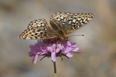
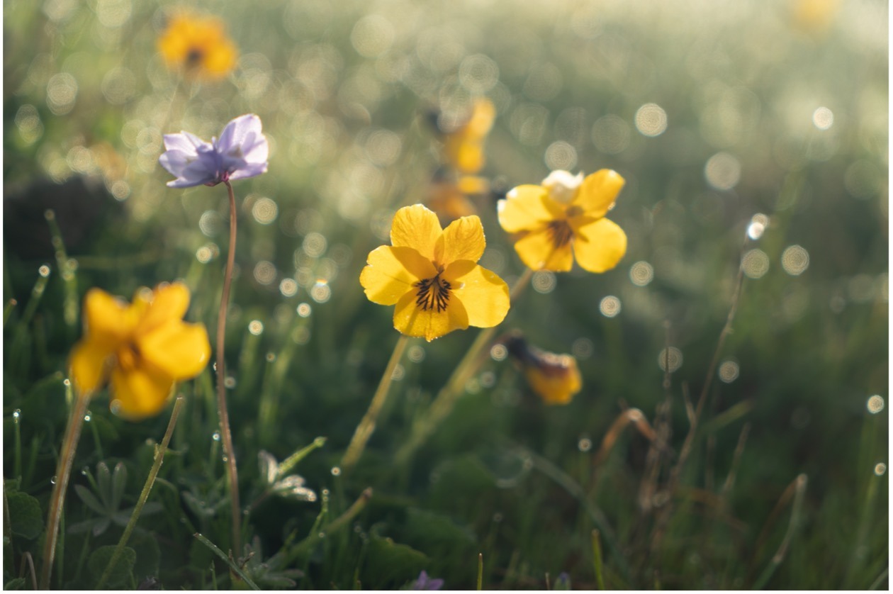
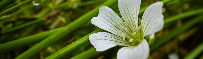
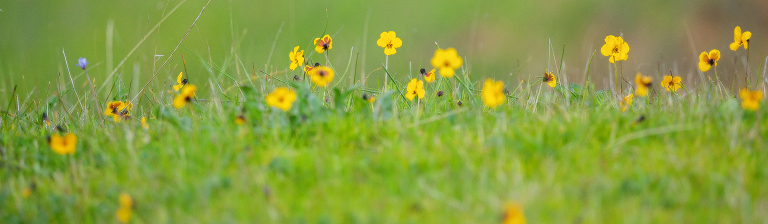
To stabilize the soil and to create the future habitat will require planting of tens of thousands of native wetland plants and willows, re-seeding of disturbed areas, and protecting the vegetation already in the area. This includes taking special consideration to protect existing populations of Viola pedunculata (also known as the California Golden Violet, or as the johnny jump up) which is the larval host plant for the callippe silverspot butterfly (Speyeria callippe callippe), a federally recognized endangered species. The only population of callippe silverspot butterfly in Sonoma County is reported in the project vicinity and additional johnny jump up plants will be added to expand the host plant population for the butterfly. In addition, nectar-producing plants are also included in the project revegetation plans to expand food sources for the butterfly across the project area.
A monitoring schedule over a minimum of five years will be required to track how the vegetation takes hold and the changes to the water table levels. If the project is successful, monitoring reports will track significantly higher water table levels in the summer which will sustain the new habitat through future droughts. In the long-term we expect to see a variety of wildlife using this habitat for shelter, foraging, and as a corridor between the baylands and the uplands.
Additional information about Stage Zero projects can be found: http://stagezeroriverrestoration.com/index.html
Saving rain for a sunny day
California is known for leading the nation on many things: cutting-edge technologies, progressive policies, and perhaps most importantly, addressing the challenges of climate change. In Sonoma County, we can be proud of our forward-thinking and novel approaches to these issues as evident in our rapid understanding and mastery of fire-adaptive land management practices in response to wildfires.
But what are we doing to address drought?
While reviewing the programs and investments addressing the need for water security in our area, an intriguing pilot program from Sonoma Water caught our attention.
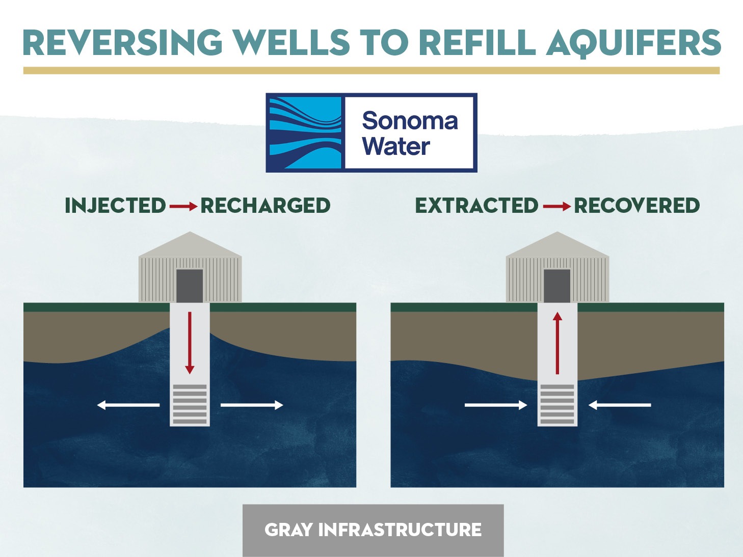
What if we rethought how we use our human-made wells (gray infrastructure) and replenish the water source instead of drawing from it? This project, known as Aquifer Storage and Recovery (ASR), could store treated, high-quality surface water in underground aquifers (nature’s reservoirs) as a way to mitigate period of drought by managing underground water supplies for our community.
By retrofitting and upgrading production wells that were originally drilled in the late 1970s, in response to a historic drought at that time, water managers will soon be able to refill one or more of these wells in wetter seasons, and then draw from them in dryer ones. These wells will recharge and produce from a sandy aquifer located approximately 300 to 800 feet below the ground and are networked in a “well field” with 18 monitoring wells that track nearby groundwater levels.
During rainy seasons when water is plentiful, this process could allow aquifers to recover and refill. However, during drier months when river water levels are low and water demands of the 600,000 people that rely on it are high, ASR production wells could retrieve the water held in the underground aquifer to supplement the Russian River supply.
“Groundwater banking is one of several ways that Sonoma Water is building resiliency into our water supply system as we face longer and more frequent droughts, as described in our Climate Adaptation Plan,” said Grant Davis, general manager. “Another example of building resiliency is our growing partnership with Sonoma Land Trust, which helps leverage staff expertise and the community connections of both organizations.”
Initial estimates for the upcoming 2024/2025 winters estimate 500 acre-feet (~163 million gallons) between two wells. With one acre-foot of water serving ~3 urban households, if the ASR project could store 500 acre-feet annually, they could provide water to approximately 1,500 homes.
This ASR process was successful in a small-scale test in Sonoma Valley and it’s hoped to be duplicated in other areas, including the Santa Rosa Plain and Petaluma Valley, where Sonoma Land Trust granted an easement to drill deepwater wells for monitoring in the Baylands. Using both natural (green) and human-made (gray) elements to solve fluctuations in water supplies can help us better adapt to droughts and water emergencies.
For more information about ASRs around California including cities in Antelope Valley that have been using ASRs for a couple of decades. Visit the links below:
Conservar la lluvia para un día soleado
California es conocida por liderar la nación en muchas cosas: tecnologías de vanguardia, políticas progresistas y, quizá lo más importante, hacer frente a los retos del cambio climático. En el condado de Sonoma, podemos estar orgullosos de nuestra visión de futuro y de los novedosos enfoques que aplicamos a estos temas, como demuestran nuestra rápida comprensión y dominio de las prácticas de gestión de tierra adaptada al fuego en respuesta a los incendios forestales.
Pero ¿qué estamos haciendo para afrontar la sequía?
Al revisar los programas e inversiones que abordan la necesidad de seguridad hídrica en nuestra zona, nos llamó la atención un interesante programa piloto de Sonoma Water.
¿Y si nos replanteamos cómo utilizamos nuestros pozos hechos por el hombre (infraestructuras grises) y reponemos la fuente de agua en lugar de extraerla de ella? Este proyecto, conocido como Almacenamiento y Recuperación de Acuíferos (ASR, por sus siglas en inglés), podría almacenar agua superficial tratada y de alta calidad en acuíferos subterráneos (depósitos naturales) como forma de mitigar los periodos de sequía gestionando el suministro de agua subterránea para nuestra comunidad.
Mediante la modernización y mejora de los pozos de producción perforados a finales de los años setenta en respuesta a una sequía histórica, los gestores del agua pronto podrán rellenar uno o varios de estos pozos durante las estaciones más húmedas y extraer agua de ellos durante las más secas. Estos pozos recargarán y producirán a partir de un acuífero arenoso situado a unos 300 a 800 pies bajo tierra y están conectados por una red de un “campo de pozos”: 18 pozos de control que monitorean los niveles de las aguas subterráneas cercanas.
Durante las estaciones lluviosas, cuando abunda el agua, este proceso podría permitir que los acuíferos se recuperaran y volvieran a llenarse. Sin embargo, durante los meses más secos, cuando los niveles de agua del río son bajos y la demanda de agua de las 600,000 personas que dependen de él es elevada, los pozos de producción de ASR podrían recuperar el agua retenida en el acuífero subterráneo para complementar el suministro del Río Ruso.
“El almacenamiento de aguas subterráneas es una de las diversas formas en que Sonoma Water está desarrollando la resiliencia de nuestro sistema de abastecimiento de agua ante sequías más largas y frecuentes, como se describe en nuestro Plan de Adaptación al Cambio Climático“, dijo Grant Davis, Director General. “Otro ejemplo de construcción de resiliencia es nuestra creciente asociación con Sonoma Land Trust, que ayuda a aprovechar la experiencia del personal y las conexiones comunitarias de ambas organizaciones”.
Las estimaciones iniciales para los próximos inviernos 2024/2025 calculan 500 acres-pies (aproximadamente 163 millones de galones) entre dos pozos. Dado que un acre-pie de agua abastece a unos 3 hogares urbanos, si el proyecto ASR pudiera almacenar 500 acres-pies al año, podría suministrar agua a unos 1,500 hogares.
Este proceso de ASR tuvo éxito en una prueba a pequeña escala en el Valle de Sonoma y se espera duplicarlo en otras zonas, como la Llanura de Santa Rosa y el Valle de Petaluma, donde Sonoma Land Trust concedió una servidumbre para perforar para instalar sistemas de monitoreo en aguas profundas en los Baylands. Utilizar elementos naturales (verdes) y hechos por el hombre (grises) para resolver las fluctuaciones del suministro de agua puede ayudarnos a adaptarnos mejor a las sequías y emergencias hídricas.
Para más información sobre los ASR en varios lugares de California, incluyendo ciudades en el Valle de Antelope que han utilizado los ASR durante un par de décadas, visite los siguientes enlaces:
- Ciudad de Roseville – (https://www.roseville.ca.us/government/departments/environmental_utilities/at_your_service/water_supply/groundwater_program)
- Ciudad de Woodland (https://www.yologroundwater.org/woodland-aquifer-storage-and-recovery)
- Península de Monterey (https://www.mpwmd.net/water-supply/aquifer-storage-recovery/ )
Frog breeding ponds – designed by beavers – built by humans
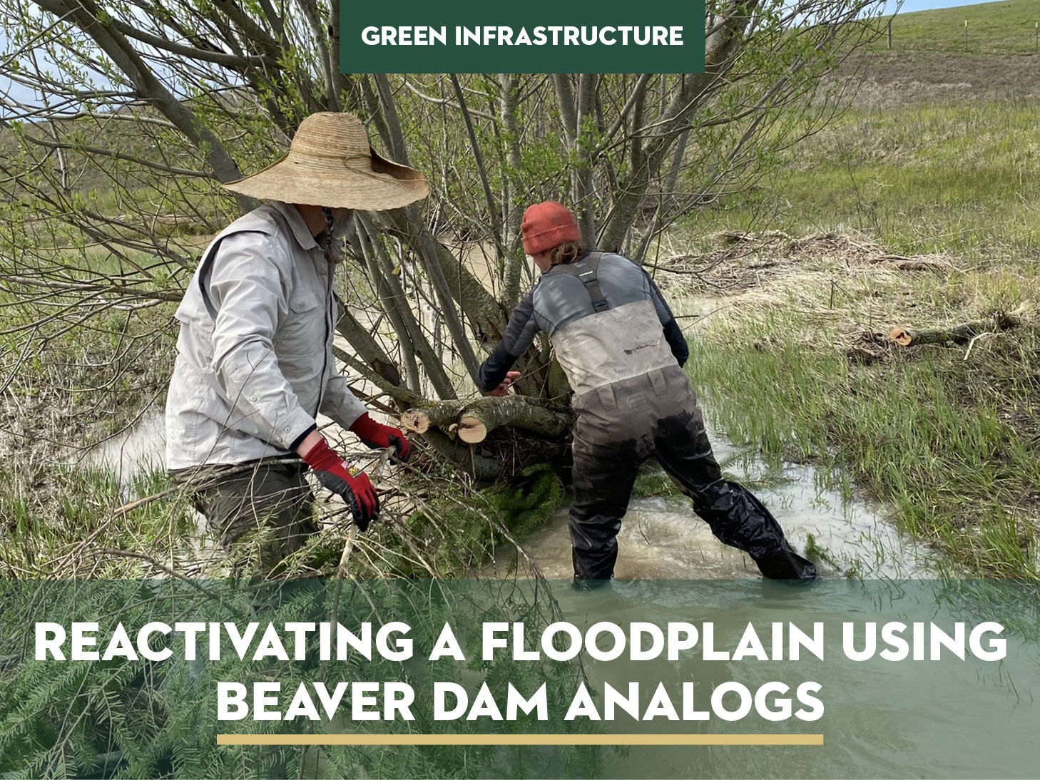
In 2012, an ambitious initiative was undertaken to construct three breeding ponds for the threatened California red-legged frog (RLF) on our Sears Point Ranch Preserve. Now, a decade later, the three ponds are lush and beautiful, but the water levels don’t allow for a long enough season for RLFs to breed. This spring, we added six, new beaver dam analogs that mimic green engineering designs that trap water to increase the flow to the ponds.
Constructing Three Ponds in 2012
For two years prior to construction, extensive measurements were taken of the groundwater height to ensure the optimal depth for the ponds. These ponds were strategically designed to mimic natural breeding habitats in an effort to attract the RLF to our preserve where we could provide them protection and increase their population. The ideal conditions for RLF breeding ponds involve adequate water levels for extended periods of time, and a drying out period for a few weeks each year to prevent the establishment of non-native, predatory bullfrogs. To recreate these conditions, we looked to nature for examples of breeding habitat and mimicked them.
The Results: Lush Ponds and Aquatic Biodiversity
Today, the three ponds at Frog Creek stand as vibrant and beautiful ecosystems, supporting a complex aquatic food web. However, a challenge remains in the short duration of water availability. The ponds dry out too quickly during early to mid-summer for RLF tadpoles to fully transform into frogs. To address this issue, we considered the options of either deepening the ponds or raising the groundwater table.
Raising the Groundwater Table and Restoring the Floodplain
To raise the groundwater table, Sonoma Land Trust invited Damion Ciotti of the U.S. Fish and Wildlife Service (USFWS) to visit the site and brainstorm with staff. For years, Damion has written about and championed the ideas of “process-based restoration,” which emphasizes restoring ecological processes and then allowing the habitat to respond. In March 2023, Damion, SLT, and Kevin Swift (Swiftwater Design) and his team constructed six beaver dam analogs (BDAs) along Frog Creek. BDAs are simply beaver dams built by people for the purpose of slowing stormwater flow and redirecting it onto the floodplain, reactivating it as a natural reservoir.
The BDAs can help recharge the aquifer, allowing vegetation on the floodplain to access water during the summer months through a process called “reactivating” the floodplain. We are grateful to Kevin and his team for constructing these dams pro bono and for successfully completing them with the support of many volunteers, including a professor from France who sought to learn these techniques for future application in his home country.
Positive Impact and Future Prospects
Although the water within the beaver dam analogs may have subsided by June 2023, some level of aquifer recharge has undoubtedly occurred. Ongoing maintenance and repairs will be required, following the beaver’s example of maintaining their dams. However, these initial efforts have already initiated change along Frog Creek, setting the stage for future restoration endeavors.
The ultimate objective is to elevate the groundwater table, enabling the RLF breeding ponds to retain water for longer periods, and perhaps someday, a return of the beaver to this area. Achieving this goal will be a gradual process, and its realization will span years and even decades. The envisioned outcome is a restored habitat where native riparian vegetation, including willows, can thrive across the floodplain. Willows are crucial for beavers, as they provide both food and shelter. Moreover, the restoration of these habitats will attract songbirds, which will utilize the willows for nesting, while foraging on the berries of coffeeberry, California blackberry, and elderberry that will also establish within the ecosystem. But the real success will be when the California red-legged frogs return, and their calls thank us for making space for them once again.
For more information and to track the progress of this project click here
Scott Hafner becomes new Board Chair and continues the family legacy
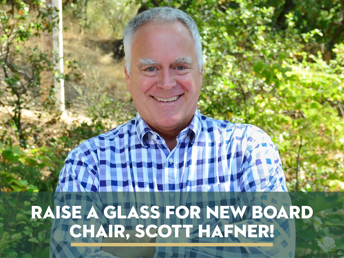
Sonoma Land Trust is proud to announce the appointment of Scott Hafner as the Chair of the Board of Directors. The son of Mary and Dick Hafner, two of Sonoma Land Trust’s earliest supporters, Scott has long championed the work of others whose mission it is to protect the health and wellbeing of our community.
Scott first joined Sonoma Land Trust in 2001 and became a member of the board in 2017. He has long been a valued and respected member of the board, sharing his deep knowledge of marketing and fundraising expertise while encouraging diverse perspectives from his fellow board members.
Scott has a successful track record of leading boards and campaigns, most recently serving as board chair at Northern Sonoma County Healthcare Foundation during the COVID-19 pandemic, a challenging time for all nonprofits, but especially health care organizations. Along with his brother Parke, Scott co-manages the family winery, Hafner Vineyard, in Alexander Valley where he oversees the financial health and marketing of the 100-acre farm which is celebrating over 50 years in business.
When Scott is not busy at work, he keeps active with his husband, Bill Glenn, supporting organizations that strengthen our community, and creating a positive impact everywhere they go.
Showing our Pride!

Did you see us at Pride? Sonoma County Ag + Open Space joined us in celebrating Pride by marching alongside our team in the Sonoma County Pride parade. Our hearts were full as we shared the love for our community with the crowds who cheered us on.
We have been asked why a land trust participates in these events, and the answer is rooted in nature. Sonoma Land Trust recognizes social and environmental movements converge in a shared vision to create a more inclusive and equitable world for all, fostering a future where human and natural diversity can thrive. We stand in solidarity and recognition of the challenges the LGBTQ+ community faces and are committed to supporting the inclusion of those who identify within this community and their allies.
We are proud to call Sonoma County home – where equity and justice for everyone is valued, supported, and celebrated.
Language of the Land:

This summer, take the opportunity to catch up on this past year’s Language of the Land webinars. View our Language of the Land playlist on Sonoma Land Trust’s YouTube channel and learn about our new strategic plan, vernal pools, the oak woodlands, and more! We’ll be back in August with a new series of webinars.
Free Public Hikes in Partnership with Sonoma County Ag + Open Space
There is no charge for these events, which are made possible by the voters of Sonoma County who fund the work of Ag + Open Space with a quarter-cent sales tax.
Estos eventos son gratuitos y son posibles gracias a los votantes del condado de Sonoma, que financian la labor de Ag + Open Space con un impuesto sobre las ventas de un cuarto de céntimo.
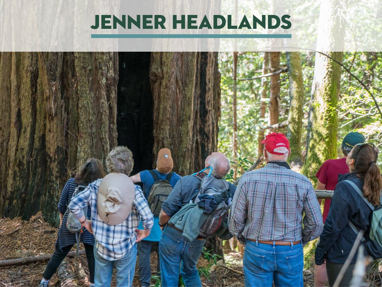
Jenner Headlands Redwood Walk
Sunday, July 9, 10am-2pm
Join Sonoma Land Trust and Ag + Open Space for a walk in the redwood forest at the Jenner Headlands Preserve. We will learn about the ecology of the redwoods as we explore the forested ridgeline of the preserve. This walk will be approximately 3 miles with about 300 feet in elevation gain.
Level: Moderate
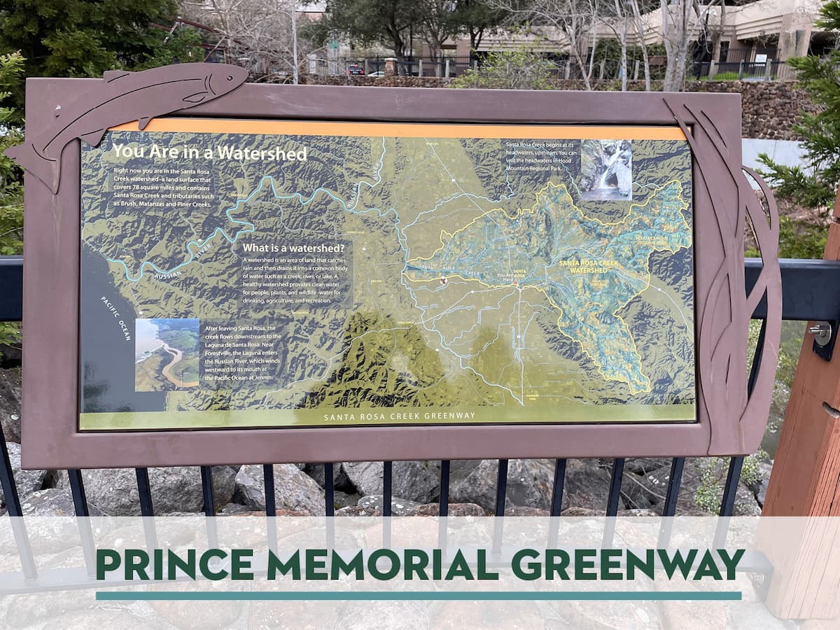
Santa Rosa Urban Walk
Monday, July 10, 6-7:30pm
Join Sonoma Land Trust and Ag + Open Space on an urban walk! This week we will explore the Prince Memorial Greenway along the Santa Rosa Creek. This gentle walk will take us through the heart of Santa Rosa, where we’ll explore the trail system, observe the artwork, and learn about how the creek ecosystem was restored.
Level: Gentle
Paseos urbanos de Santa Rosa
Lunes, 10 de julio, 6-7:30pm
¡Acompañe a Sonoma Land Trust y Ag + Open Space en un paseo urbano! Esta semana exploraremos Prince Memorial Greenway a lo largo del arroyo Santa Rosa. Este paseo suave nos llevará por el corazón de Santa Rosa, donde exploraremos el sistema de senderos, observaremos las obras de arte y aprenderemos cómo se restauró el ecosistema del arroyo.
Nivel: Suave
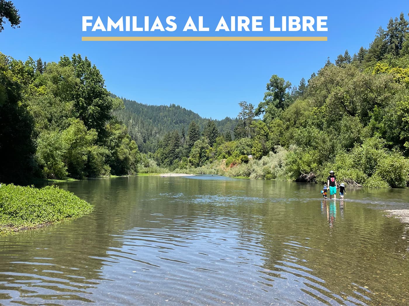
Families Outdoors
Russian River Sunset Beach
Saturday, July 22, 9am–2pm
Join Sonoma Land Trust and Ag + Open Space for this month’s Familias al Aire Libre adventure to Sunset Beach River Park on the Russian River. This free Spanish-led bilingual family outing begins in downtown Santa Rosa and includes transportation. Bring your swimsuit, beach blanket, and a picnic and enjoy a day with us on the beach and in the water! Sign up online or call or text Tania at 707.324.3510.
Familias al Aire Libre
Russian River Sunset Beach
Sábado, 22 de julio, 9am–2pm
Acompañe a Sonoma Land Trust y Ag + Open Space para la aventura de este mes de Familias al Aire Libre a Sunset Beach River Park en el río Ruso. Esta excursión familiar bilingüe gratuita en español comienza en el centro de Santa Rosa e incluye transporte. Traiga su traje de baño, toalla de playa, y un picnic y disfrute un día ¡con nosotros en la playa y en el agua!
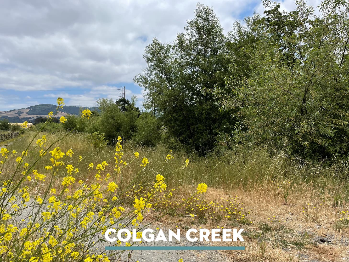
Santa Rosa Urban Walk
Monday, July 31, 6-7:30pm
Join Sonoma Land Trust and Ag + Open Space on an urban walk! This week we will explore the Colgan Creek Trail in southwest Santa Rosa. As we walk along this gentle trail we’ll learn about the work that has gone into restoring this ecosystem and enjoy the beautiful views across the Santa Rosa Plain.
Level: Gentle
Paseos urbanos de Santa Rosa
Lunes, 31 de julio, 6-7:30pm
¡Acompañe a Sonoma Land Trust y Ag + Open Space en un paseo urbano! Esta semana exploraremos el sendero Colgan Creek en el suroeste de Santa Rosa. Mientras caminamos por este suave sendero aprenderemos sobre el trabajo que se ha realizado para restaurar este ecosistema y disfrutaremos de las hermosas vistas de la llanura de Santa Rosa.
Nivel: Suave
Additional Hikes
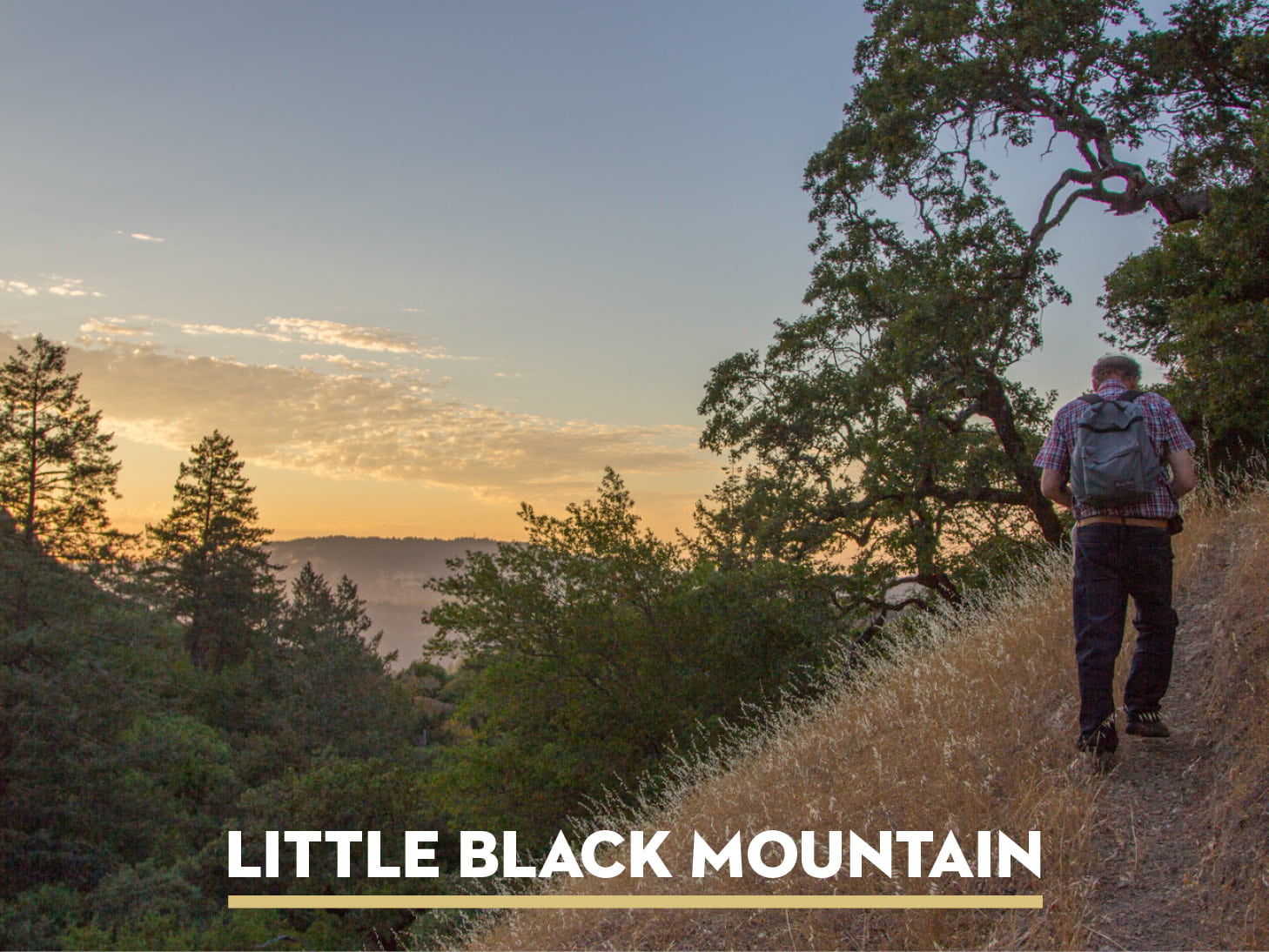
Summer Sunset Hike
Little Black Mountain
Thursday, July 20, 5-8:30pm
Join Sonoma Land Trust for a summer sunset walk on Little Black Mountain Preserve near Cazadero. This moderate hike will take us through a mixed forest ecosystem along the north side of Pole Mountain. We’ll enjoy the late evening light in the sky and take in some beautiful views along the way.
Level: Moderate
Caminatas al atardecer en verano
Little Black Mountain
Jueves, 20 de julio, 5-8:30pm
¡Acompañe a Sonoma Land Trust para un paseo al atardecer de verano en Little Black Mountain Preserve, cerca de Cazadero. Esta caminata moderada nos llevará a través de un ecosistema de bosque mixto a lo largo del lado norte de Pole Mountain. Disfrutaremos de la luz del atardecer en el cielo y de unas hermosas vistas por el camino.
Nivel: Moderado
Recommendations

- Book: Integrating Green and Gray: Creating Next Generation Infrastructure
- Podcast: Ripple Effect: 126: Beaver Dam Analogs
- Video: Gray, Green, Blue: Water Security and YOU!
- Webinar: Language of the Land: Adapting to Rising Waters
- TED Talk: https://www.ted.com/talks/glynnis_hood_why_do_beavers_build_dams
- App: 5 Apps to help you save water