Blog
Climate resilience in the face of a record El Niño
By Melodie Grubbs, Director of Conservation
Around the world, from climate scientists and policymakers to everyday people wondering what to make of the headlines, El Niño continues to be a daily topic of conversation—and for good reason. In this month’s newsletter, I want to unpack what it actually means for the land and habitats we steward and for our community here in Sonoma County.
El Niño is a global phenomenon. The environmental processes it sets in motion have the potential to change local weather and climate in different ways in different parts of the world. In California, our main concerns are:
- increased wave energy, which drives erosion of our coastlines and beaches
- more moisture in the air, leading to higher-intensity rainfall and stronger winter storms that could cause mudslides and falling trees
- sea level rise, leading to flooding along any bodies of water connected to the ocean
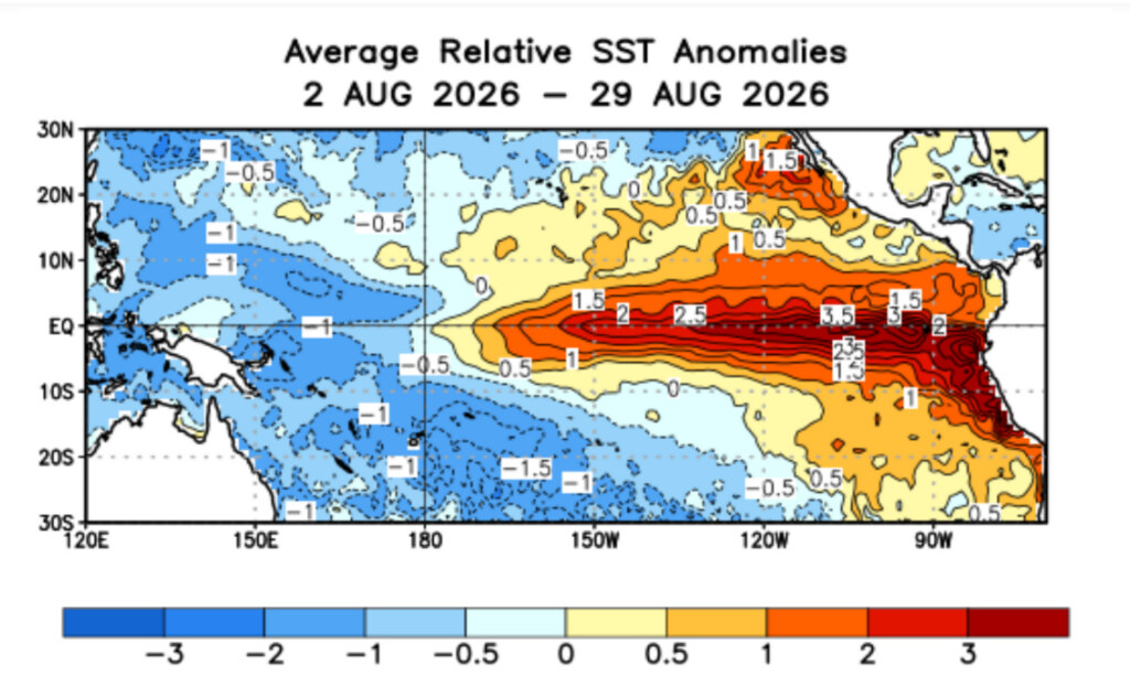
In Sonoma County specifically, what’s caught my attention is that the indicators right now suggest the strongest El Niño on record. And what we’re seeing with climate change is more intense weather phenomena overall. When I think about what worries me, it’s the compounding effects of the issues our lands already face—warming climate, wildfires, invasive species, landscapes that are being restored but still recovering—with El Niño layered on top. Strong, big shifts like this can have lasting effects for years to come.
What El Niño Could Look Like Here
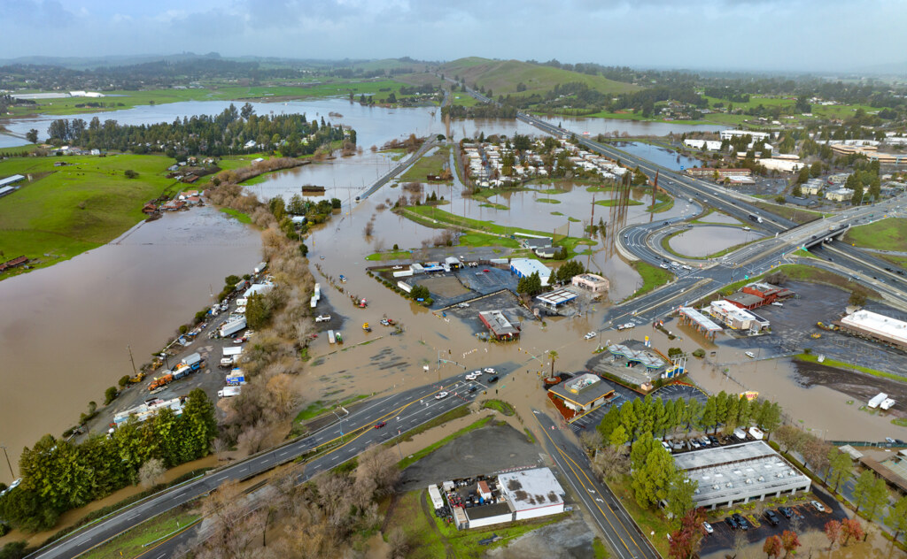
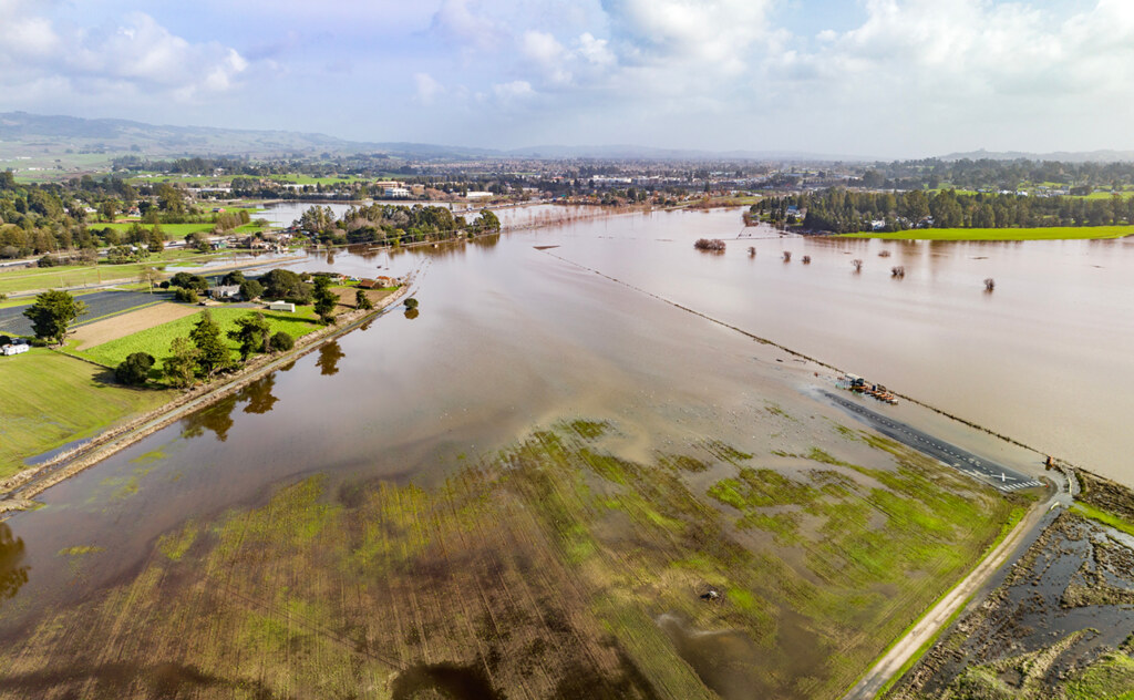
On land, the risks I’m thinking about most are post-burn landscapes where vegetation isn’t strongly established yet. There’s a lot of exposed ground cover, and from what we’ve seen in other El Niño events, that can mean erosion and mudslides. Many of us still remember the February 2019 atmospheric river that sent the Russian River cresting to over 45 feet, turning Guerneville and Monte Rio into islands reachable only by kayak, or the 2025 storms that flooded Highway 101 near Healdsburg and sent an entire Forestville home sliding into the Russian River after a landslide undermined the saturated hillside beneath it. Severe flooding can also move sediment around, reshaping creek channels and riparian areas in ways that linger for years. These are dynamic systems, and they’re supposed to change—but when they’re repeatedly hit by extreme disturbances, the question becomes: can the system recover to its previous state, or does it need intervention?
On the coast, the compounding factors are significant. During El Niño, warm water thermally expands, raising ocean levels. In fact, seawater at 20°C expands more than twice as fast per degree of warming as seawater at 10°C, which is part of why El Niño years amplify this effect more than a typical warm spell would. Pair that with naturally occurring king tides—which can run six or seven feet above baseline—and a big storm with storm surge that can add several additional feet of water on top of already elevated sea levels, and your risk for coastal flooding increases exponentially. What might normally be a foot of flooding could become eight feet. It can erode cliffs, narrow beaches, and make the coast genuinely dangerous to be on during bad storms. It can also cut off coastal communities entirely. During past flood events, the Bohemian Highway—one of only two evacuation routes out of the west county—has been rendered impassable, leaving Highway 116 along the swelling Russian River as the only way out. During really bad stormy events, avoid the beach!
How We’re Responding
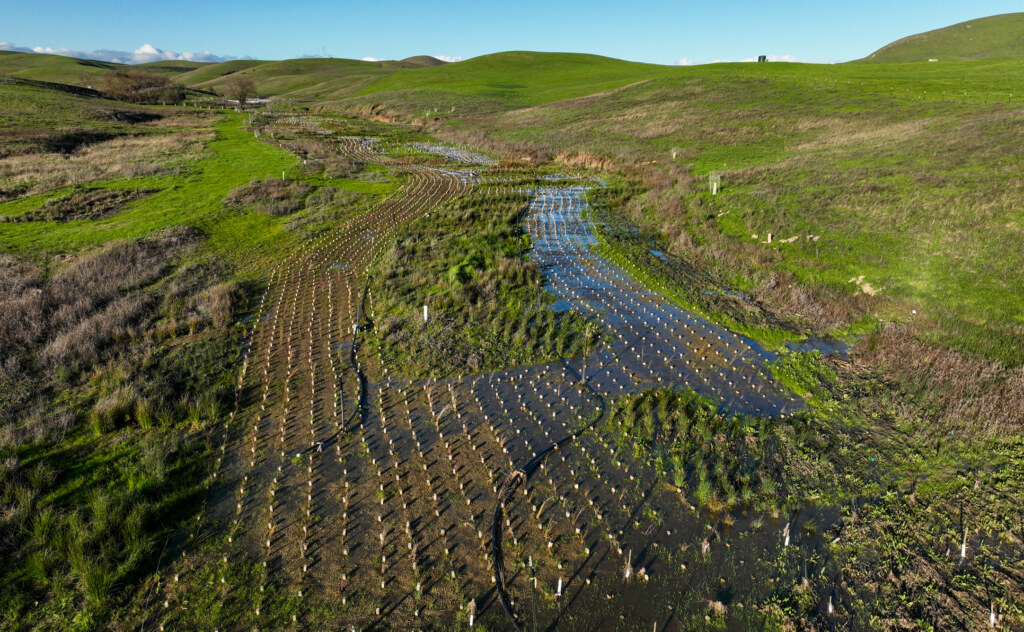
We are actively factoring El Niño into our planning, especially when considering timing—is this the right moment to undertake a particular project? For some projects, wetter conditions might mean adjusting when and how we carry out work on the ground. We have projects like Lakeville Creek Stage Zero Restoration that are meant to be dynamic systems, designed to interact with water, storm events, and runoff. Those will be put to the test, and I think this will be a good opportunity to see how the systems we’ve restored actually respond.
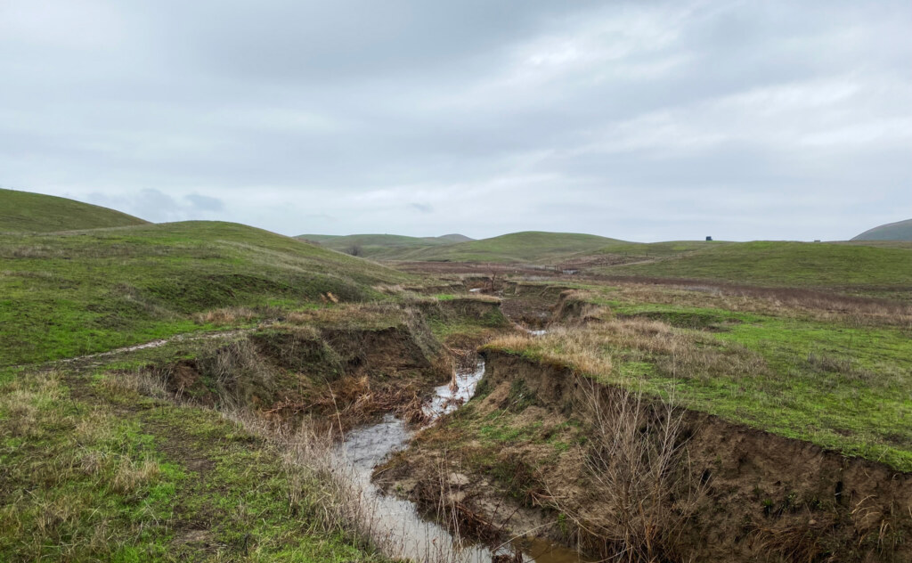
That’s where the concept of adaptive management comes in. At a high level, that means you’ve designed and implemented a restoration project using the best available science, and then the system gets tested—by a big flood, an El Niño, an extreme event. We monitor how the system’s functions changed under the new stressors and learn which elements worked well and which need to be adapted. For example: when plants washed out at Lakeville Creek one year after planting and before the young plants established deep roots, a big winter storm washed huge swaths downstream, requiring us to redesign and replant. That doesn’t mean the effort failed, however; that’s just the nature of working in complex, dynamic systems. That’s adaptive management.
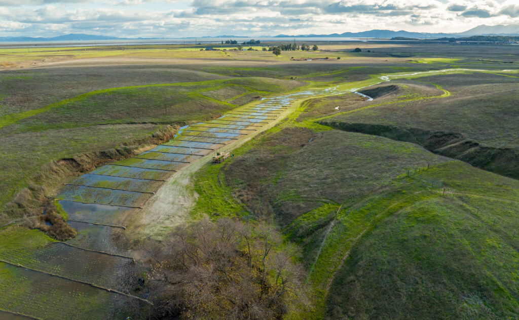
If we don’t embrace approaches like restoring floodplains, allowing controlled flooding in areas we predesignate for that purpose, and prioritizing groundwater recharge, we miss out on solutions that support both ecosystem health and flood risk management for our communities. These nature-based solutions also tend to be far less expensive than building hard infrastructure, and the cost of a failed infrastructure project can be staggering.
Take Gleason Beach for example, right here on Sonoma Coast. Decades of traditional retaining walls and coastal armor failed to stop severe cliff erosion from rising seas, and at least 11 homes fell into the sea when the bluff collapsed. The eventual fix of moving a mile of Highway 1 roughly 400 feet inland and building an 850-foot bridge cost $77 million.
The Silver Lining
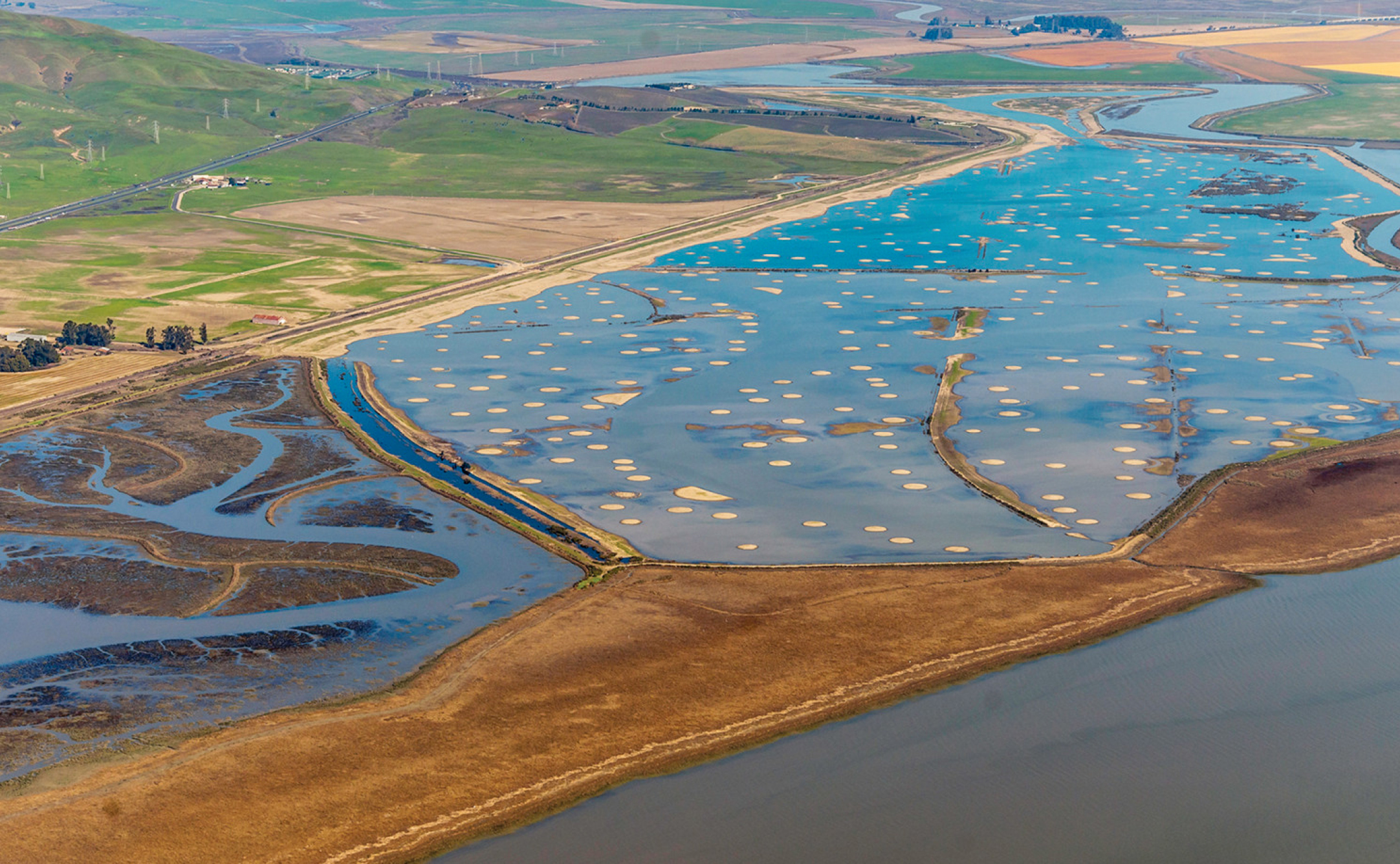
The silver lining is that this is a real opportunity to learn as we implement new techniques for a future with increasingly variable conditions. We’ll conduct reconnaissance across our preserves, from the Baylands to Lakeville Creek to smaller systems like Vernal Pools in Glen Ellen, to see how they respond. Our preserves are in various conditions, with some well-restored and others still recovering from fire or historical disturbance. Observing how that range of landscapes responds to potential extreme events will tell us a lot about what’s most at risk and where we should prioritize our efforts moving forward.
These observations are valuable not just to us but to practitioners across the state. There’s also talk among partners and scientists of coordinating more regional data collection around this event. El Niño events only come around every few years, and we don’t yet have a large historical dataset, so a strong one like this is an opportunity to learn. It’s also an opportunity to see what some of the effects of climate change (such as sea-level rise) could be over the next few decades, which will give us insight into how we can prepare.
What You Can Do
Check your local city or county resources for emergency preparedness guidance. They often have good information on sandbags and materials you might need ahead of time. And please be careful on the roads. We have a lot of roads near the Russian River and near creeks that can flood quickly. Six inches of water can sweep a car away! Take flood advisories seriously and be mindful about moving around when conditions are bad.
The big takeaway: be prepared for potential extreme and intense storm events. Be adaptable. We’re working in systems that are dynamic, and these types of extreme events have the ability to dramatically change landscapes. There’s not much we can do to stop it, but by learning from what happens, we can create more climate-resilient projects and habitats moving forward.
Follow along at the new ENSO blog and Daniel Swain’s Weather West for El Nino updates