Blog
High tech, low tech: Inside our field toolkit
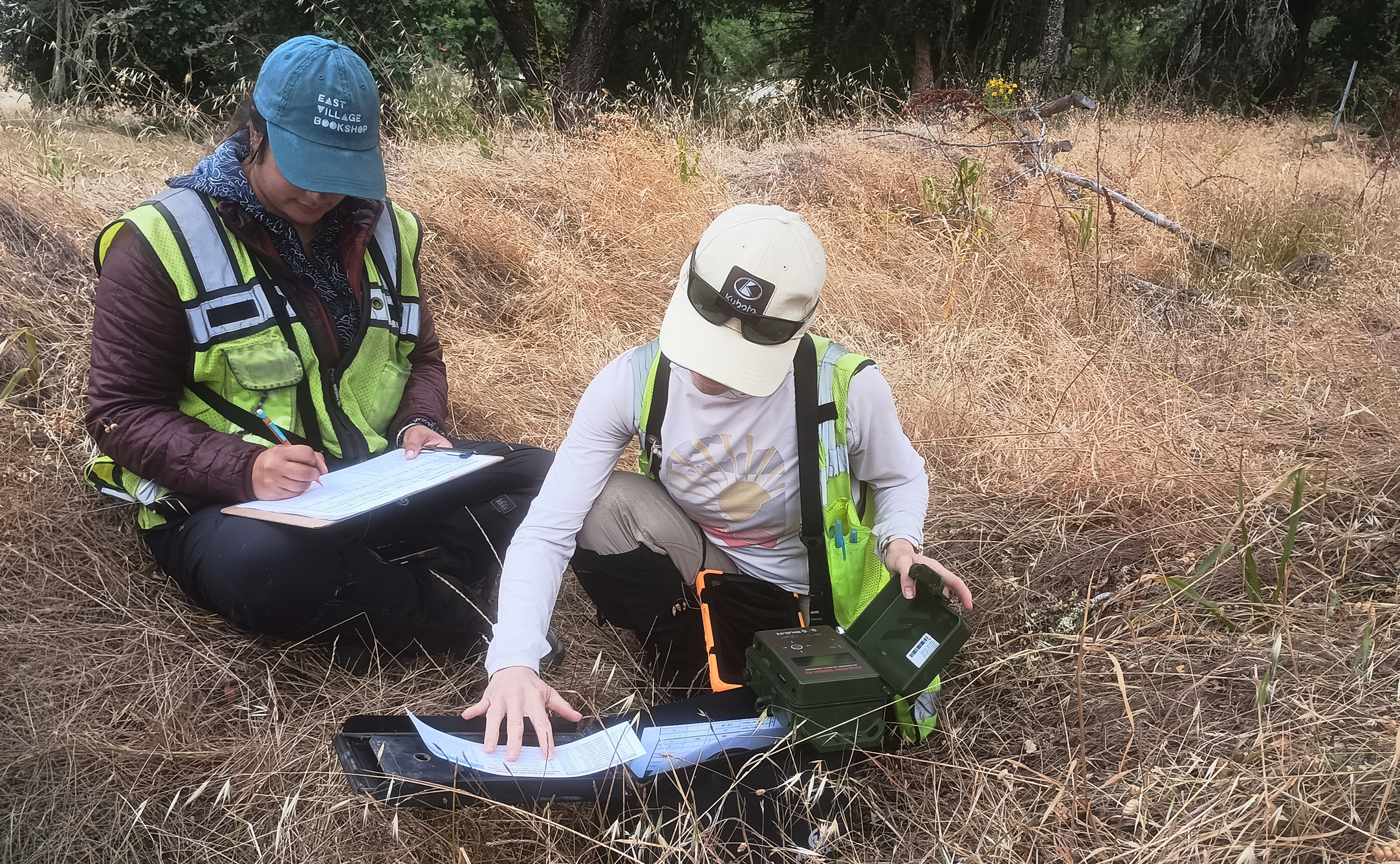
You might picture stewardship work as boots, binoculars, and a field notebook—and a lot of it still is. But behind the scenes, our team relies on a growing toolkit of technology to monitor wildlife, track habitat change, and make smarter decisions about the land we protect. Here’s a look at some of the tools we’re using out on the land.
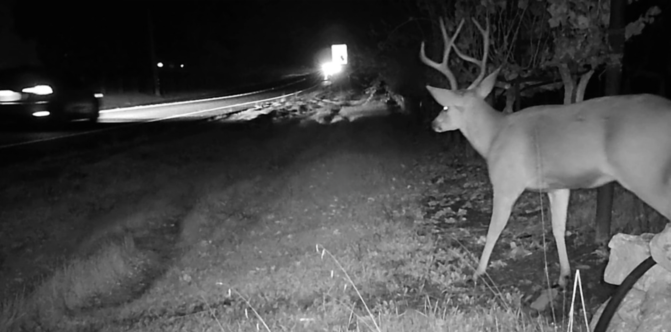
1. Wildlife Cameras, Now Capturing Video
The classic trail camera has leveled up. “The big change from 10 years ago is that we’re now using video because the software and image quality have improved enough to make it worthwhile,” says Sonoma Valley stewardship program manager Chris Carlson. These cameras are central to our Highway 12 wildlife crossing study, which aims to identify where wildlife are having problems crossing the highway safely. Video also allows us to observe whether wildlife cross the road successfully, or observe their behavior when they don’t, which is vital information in helping us plan where and what kind of infrastructure improvements would help the most.
2. Cell-Enabled Cameras for Remote Monitoring
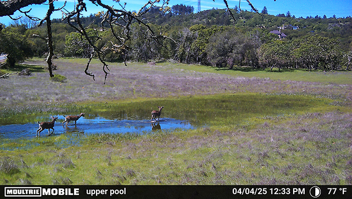
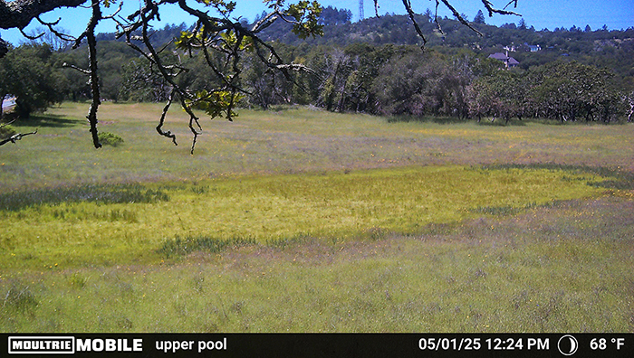
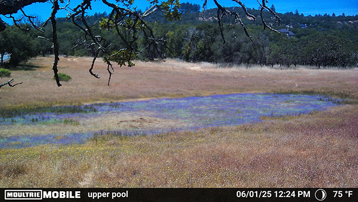
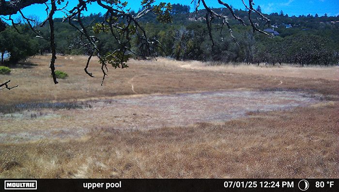
At one vernal pool site, Chris installed a cell-enabled camera—which transmits photos and video wirelessly over a cellular network, like a trail camera with a built-in SIM card—to monitor water levels and track seasonal changes over time. “I put up a cell-enabled wildlife camera so I wouldn’t have to go check the SD card to monitor the vernal pool itself when it’s filling with water,” he explains. The camera is great at capturing phenology—the timing of seasonal cycles like flooding, drying out, flowers blooming, and wildlife activity—and produces striking timelapse footage of the pool moving through the seasons. It also serves a secondary purpose: keeping an eye on whether people are using the property without our team’s knowledge.
3. LiDAR-Based Vegetation Mapping—Ground-Truthed on Foot
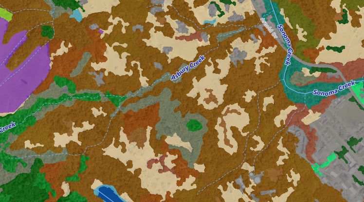
LiDAR—which stands for Light Detection and Ranging—uses laser pulses to measure the elevation of surfaces with remarkable precision. Unlike an aerial photograph, which can show you where a forest ends and a grassland begins, LiDAR reveals the shape of the land beneath, such as: how tall the tree canopy is, how incised a stream channel is, how much a diked bayland has subsided over time.
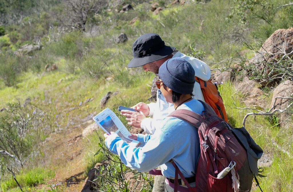
For the natural resources study at the former Sonoma Developmental Center, the team used the fine-scale Sonoma County vegetation map that is built from a combination of aerial photography and LiDAR data. Then, they headed out on foot to verify what the data was actually showing on the ground. “You can see an oak woodland from the aerial, but you can’t see a native grassland because they’re native grasses mixed in with non-native grasses,” Chris explains, which is why the tech only gets the team most of the way there.
4. Acoustic Monitoring
We have partnered on multiple bioacoustic projects across our preserves, including a study with the Cornell Bird Lab and the “Soundscapes to Landscapes” project with Dr. Matthew Clark at Sonoma State University. Using a network of low-cost acoustic recorders and the help of community scientists, the project captured soundscapes across Sonoma County—bird calls, natural sounds, and human noise—then combined that data with satellite imagery to map biodiversity patterns across the region at a scale that would otherwise be impossible.
Chris’s team is now running an acoustic monitoring effort focused on bats. Sound (and light) matter more to wildlife connectivity than people often realize, says Chris, and “can be just as much of a barrier as a fence or a highway.”
Acoustic monitors can record thousands of calls in a single night—far more than any team could manually review—so the project relies on machine learning algorithms to process the recordings and identify species by their unique call signatures. That library of signatures was itself built by humans, who painstakingly recorded and catalogued bat calls in the field over many years. There is currently relatively little information about bats in Sonoma County, so this study will also be one of the first to start gathering important information about bat biodiversity here in the region.
5. Temperature and Salinity Sensors
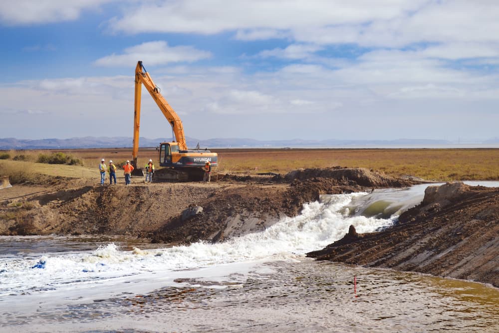
For our work in the Baylands, the team is preparing to install water quality sensors that will track temperature and salinity, which will help monitor how tidal and freshwater systems are changing over time. As sea levels rise and restoration work reopens historic tidal flows, these measurements will help us understand how conditions are shifting for native species like fish and marsh plants that depend on a precise balance of salt and fresh water to survive.
Baylands program manager Julian Meisler plans to use water quality meters to track salinity, temperature, and dissolved oxygen, he says, to better understand red-legged frog and beaver habitat in hillside ponds and lowland brackish marshes.
6. Groundwater Well Monitoring
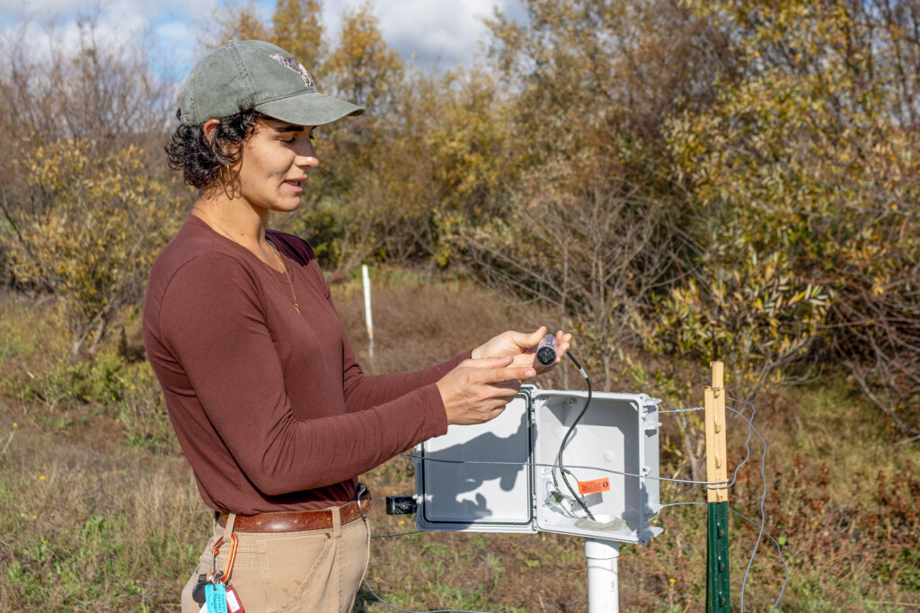
Healthy land isn’t just about what you can see on the surface. Groundwater wells allow the team to track subsurface water levels across the seasons, providing a fuller picture of how water moves through the landscape and how restoration efforts are affecting it over time.
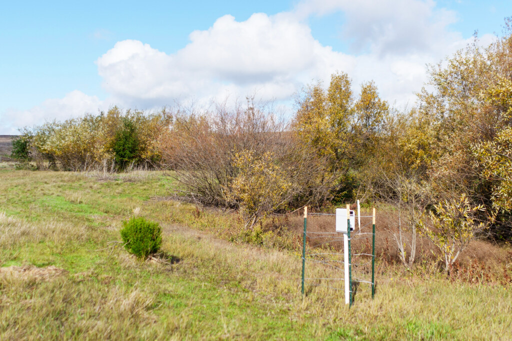
We can see the behavior of surface water easily, but once the water goes underground, we don’t know what it’s doing. Groundwater wells allow us to monitor the behavior of the water table and use it to plan restoration projects, explains Baylands stewardship project manager Riley Scaff. And when we implement those restoration projects, it allows us to see the transformation in the behavior of groundwater.
At the Lakeville Creek restoration site, that transformation has been incredible to watch, she says. Before restoration, the ground acted like a leaky pipe. When it rained, the water table rose quickly, but drained just as fast, preventing wetland vegetation from surviving once the ground dried out. Once we restored the stream valley from an eroded ditch back to a flat, gently sloping meadow, the ground began acting more like a sponge, absorbing water slowly and releasing it gradually. With the water table staying shallow near the surface, plant roots can reach it, allowing plants to establish and survive.
“Groundwater is the foundation of the ecosystem, and water is literally life,” says Riley. “By fixing the hydrology, we were able to bring back this ecosystem that used to thrive here, and now it gets to thrive again.”
Check out our latest Lakeville Creek Update with exciting results from recently-installed groundwater wells.
7. GIS Mapping
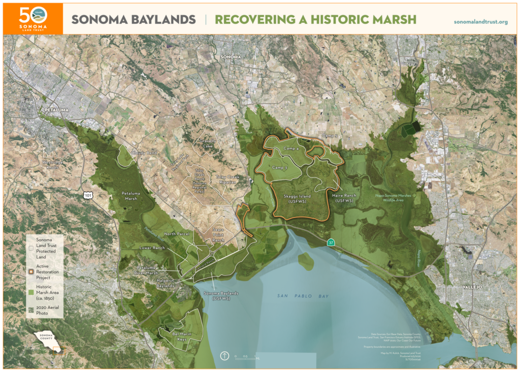
Geographic Information Systems (GIS) have long been central to creating maps for conservation planning, but the tools have advanced considerably. Today, GIS allows our team to layer land ownership, habitat type, elevation, hydrology, fire history, and wildlife data onto a single map, making it possible to spot patterns, identify gaps, and modernize the way we prioritize our work. As our land portfolio has grown, so has our reliance on GIS to manage it well, and we recently welcomed GIS Program Manager Maryrose Kulick to oversee the program.
“I love the multiplicity of GIS,” says Maryrose, who thinks deeply not only about the information a map can hold but also about the story it can tell. “It is at once a science, an art, and a powerful tool for making sense of the world around us.”
8. Drones
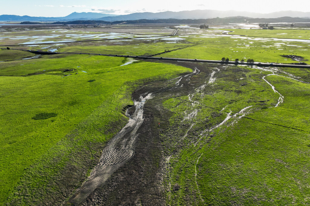
What used to require a small plane can now be achieved with a camera-equipped drone. From checking ground conditions after a storm to monitoring prescribed fire and assessing the progress of restoration projects like the work at Lakeville Creek, drones give our team a bird’s-eye view that is faster, cheaper, and more nimble than a plane.
9. Virtual fences
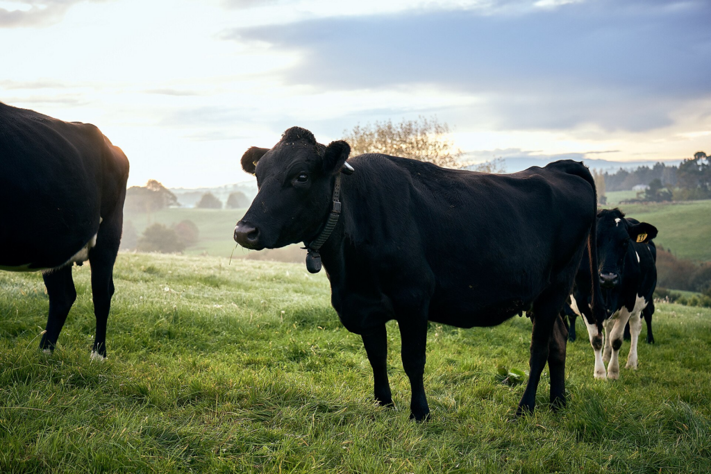
Conservation grazing is a powerful tool for managing vegetation, reducing fire risk, and supporting healthy grasslands, but getting cows to graze in exactly the right places at the right times is easier said than done. Virtual fence technology uses GPS collars coupled with audio and vibration cues to create invisible boundaries that can be adjusted remotely, allowing ranchers to guide herds with precision. That means keeping animals away from sensitive waterways, preventing overgrazing in vulnerable areas, and directing grazing pressure exactly where it’s needed.
Currently, we’re using virtual fences at our Live Oaks and Estero Americano preserves with plans to implement them at two other locations, says stewardship program manager Tom Tolliver. The virtual fence system allows the livestock operator who leases our properties greater control over where cattle are grazing while significantly reducing or even eliminating our financial cost and carbon footprint of constructing physical fences. “It’s a win-win for Sonoma Land Trust and the environment,” says Tom.
10. Boots on the ground!
For all the sensors, cameras, and mapping software, there’s no substitute for people spending time out on the land. Advanced technologies can help us work more efficiently, capture and process immense amounts of data, and detect changes that would be invisible to the naked eye. But long-term stewardship requires an intimate knowledge of place that can only be built over years of showing up, slowing down, and paying close attention.