Blog
over the (digital) river and into the (literal) woods
by Crystal Simons
Properties protected by conservation easements are unique. A conservation easement is a voluntary legal agreement between a landowner and Sonoma Land Trust (or any organization qualified to be an easement holder) that keeps the property in private ownership while protecting key resources.
A conservation easement is a flexible and legally binding tool that is tailored for each property based on the common preservation goals of the original landowner and the Land Trust. The agreement restricts specific uses of a property into the future … forever. For example, a conservation easement might prohibit subdivision, restrict the location of new buildings or prevent expansion of an existing use, like a vineyard or timber mill.
The conservation easement is recorded with the County in the form of a grant deed and is binding on current and future owners of the property in perpetuity. Yes, that’s right … forever. In return, along with the satisfaction and security that their often beloved, resource-rich land will be protected, landowners may be eligible to receive tax benefits for protecting their land. Sonoma Land Trust has committed to monitoring and enforcing 46 unique conservation easements on diverse properties across Sonoma County. No two conservation easements — or properties — are alike.

- To maintain good relationships with landowners.
- To observe and document changes to the land.
- To identify potential violations to the conservation easement, and resolve them quickly and smoothly.
- To create and maintain a record.
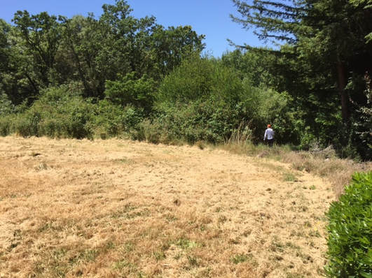
The site visit begins with a rendezvous of the conservation monitors — a team of two to four trained volunteers, SLT staff and the landowner if/when they’re available. We look over aerial maps and monitoring reports from previous years with our tools in hand: clipboards, cameras or smartphones, GPS units, a compass, water bottles, snacks and prepared forms for taking field notes. As we plan our monitoring route, the group’s energy is always giddy. We are eager to begin the hike to the first monitoring point or “photo station.”
At the first photo station, we take any necessary photos, make notes about what we observe and describe any anthropogenic or naturally-caused changes. These observations could be a new shed, a landslide or a tree that might have fallen across a road. We note the cardinal direction in which the photo was taken, assign it a number and mark its location on the field map. Back in the office, our GPS data will confirm the photo location with greater accuracy, but it is a test of skill when one can identify the photo station with graphite on paper. Indeed, analog skills are a source of pride in our increasingly digital world.

The monitoring day is done, but the monitoring reporting has yet to begin. In the coming days, the lead monitor will upload the data collected onto their computer, save the digital photograph and GPS files, create a final monitoring map, write a narrative, type up the field notes and finalize documentation of the day’s observations. The final report is reviewed by staff and filed — a scanned version into our digital files and the printed original to a fire-safe storage facility called “Fort Docs” — truly a fortress of bankers boxes, full of real, tangible original documents.
When the hours are counted, it is clear that more time is spent in front of the glowing screen than under the swaying tree tops. The days in the field remind us why we choose to work in conservation. Conservation easement stewardship work is full of purpose and intent, but being on the land (literally) is what it’s all about.