
Highway 37 Redesign
Bumper to Bumper
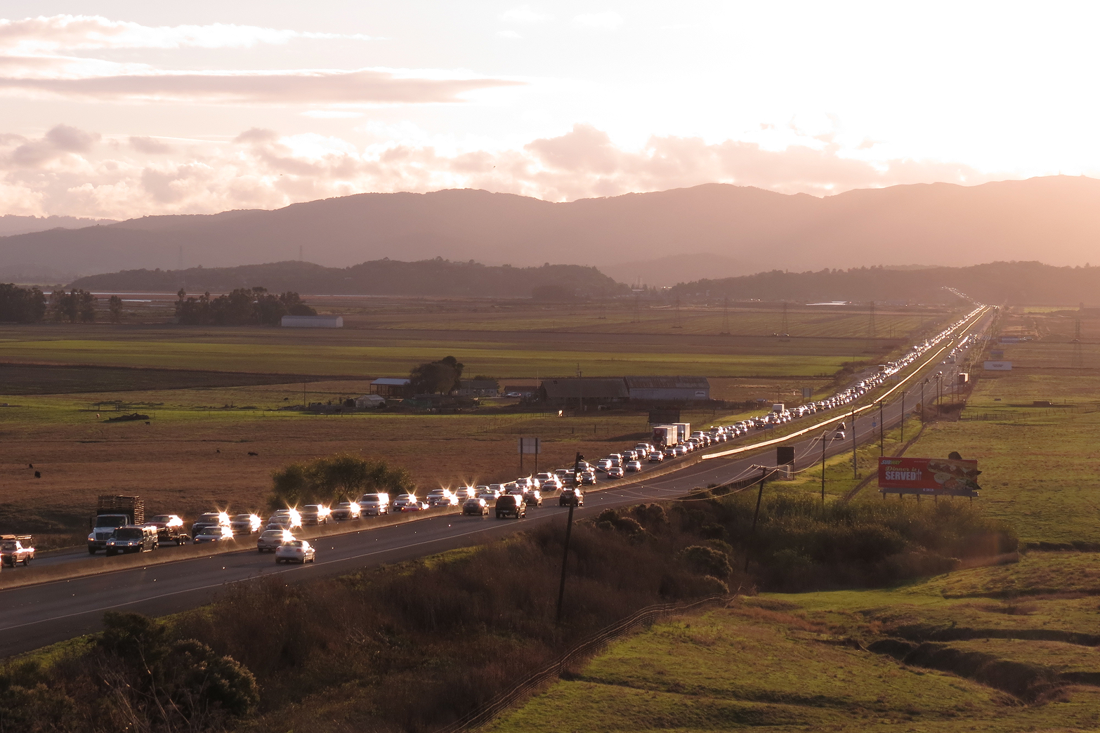
More than 40,000 cars drive along State Route (SR) 37 daily, flooding the 21-mile roadway with bumper-to-bumper traffic on their way to Marin, Sonoma, Napa, and Solano Counties. Drivers, already facing lengthy commute times, are likely in for worsened congestion as the population increases. On top of that, rising sea levels are causing another headache for commuters: flooding. In 2017, catastrophic flooding closed the highway for nearly a month and it’s only likely to get worse with climate change.
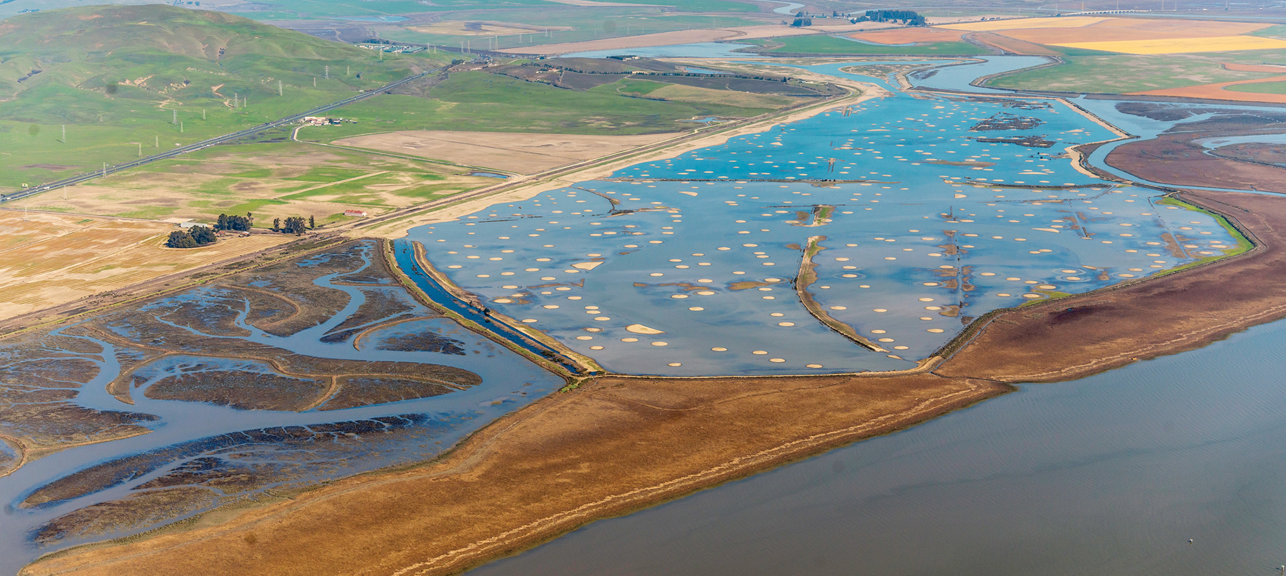
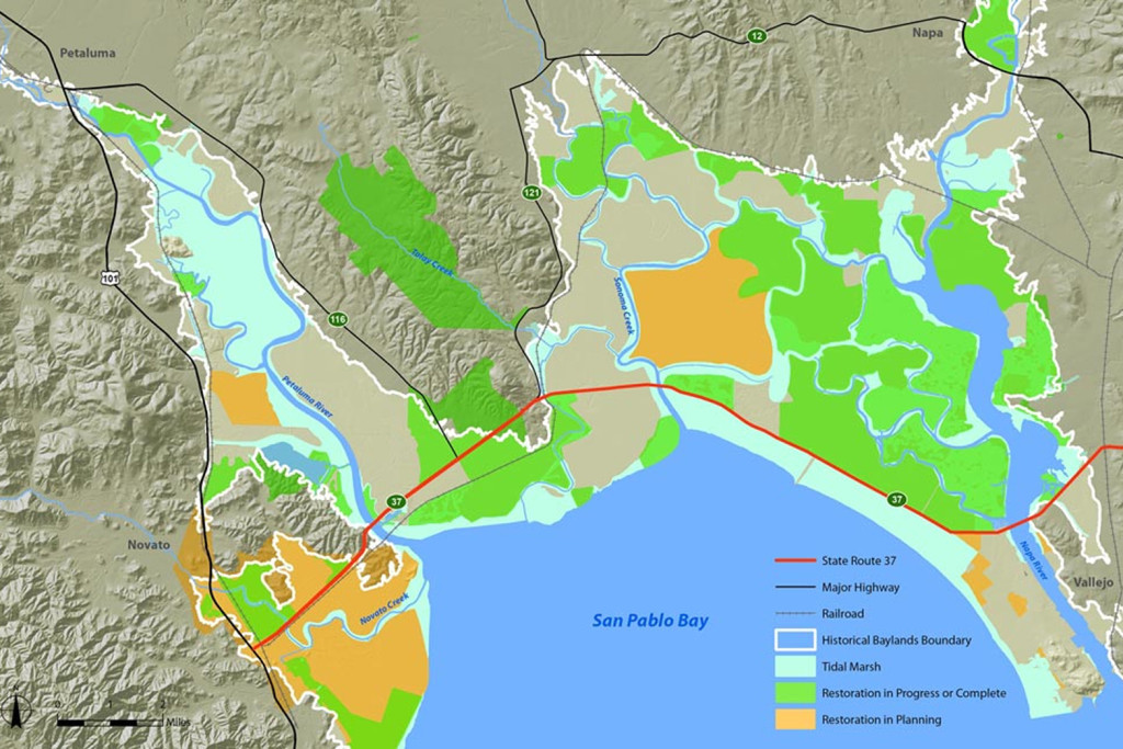
The highway sits parallel to the northern arc of San Pablo Bay—an extension of San Francisco Bay. Characterized by tidal and seasonal wetlands, the bay serves as an important buffer between urban areas, agricultural land and infrastructure, including Highway 37.
The redesign of State Route 37—currently in early planning—represents a once-in-a-generation opportunity, as well as a potential threat, to achieving conservation goals for North Bay tidal wetlands. A redesign of this major thoroughfare will directly affect the ecological health and resilience of thousands of acres of wetlands along the North Bay shoreline and impact the future of decades of conservation investment in the region’s wetlands.
Redesigning a Highway
The need for redesigning the highway is apparent; however the redesign must protect the values and services that the surrounding natural and agricultural landscapes provide. Significant public investments have already been made along SR 37 to protect and restore wetlands and connected habitats, increase climate resilience, and protect infrastructure, including SR 37. Continued investment in long-term resilience now will pay enormous dividends for future generations.
Sonoma Land Trust and the California State Coastal Conservancy, along with North Bay wetland managers, ecological restoration practitioners, and other stakeholders, formed the State Route 37−Baylands Group to represent the interests of the wetlands during the redesign. Sonoma Land Trust and the State Route 37−Baylands Group are working closely and cooperatively with the Metropolitan Transportation Commission and Caltrans on this effort. We are committed to ensuring that the redesign is in line with and advances the ecological restoration and conservation goals for the San Pablo Baylands.
The State Route 37−Baylands Group prepared a white paper in 2017 to provide recommendations to the highway redesign. Read it here.
In July 2022, the State Route 37-Baylands Group and other stakeholders published a position paper on SR 37 planning and redesign. The Baylands Group reiterated its support for a SR 37 multi-modal, multi-benefit ultimate project on a pile-supported causeway along the current SR 37 alignment to enable timely flood risk and congestion management, along with wetland restoration. We recommended that all interim projects be low-cost, low-impact fixes or serve as initial phases of the ultimate project. Read it here.
Read San Francisco Chronicle article here from July 16, 2021: Rising Reality: Elevating roadway to thwart its demise.
Sonoma Creek Baylands Strategy
In May, 2020, Sonoma Land Trust completed the Sonoma Creek Baylands Strategy. This is a high-level plan for the lower Sonoma Creek watershed between State Route 121 in Schellville and San Pablo Bay that:
- Coordinates the protection, acquisition, restoration, and enhancement of diverse baylands habitats
- Integrates natural processes to increase climate resilience
- Identifies opportunities for public access
- Provides recommendations for SR 37 and the SMART rail line
The Sonoma Creek Baylands Strategy was funded by San Francisco Bay Restoration Authority, U.S. Fish and Wildlife Service, Resources Legacy Fund, and Dolby Family Fund. Project partners included San Francisco Estuary Institute, Point Blue Conservation Science, Ducks Unlimited, ESA, Sonoma Water, California Department of Fish and Wildlife, and U.S. Fish and Wildlife Service. The study’s development was peer-reviewed by a Science Advisory Panel.
In development of this project, Sonoma Land Trust met with many of the public and private property owners in the study area. Sonoma Land Trust looks forward to implementing our restoration vision in the Sonoma Creek baylands in partnership with interested landowners.
Petaluma River Baylands Strategy
The Petaluma River is perhaps one of the bay’s best kept secrets. Among its treasures is the more than 3,000-acre marsh that is the bay’s largest remaining “ancient marsh.” More than 2,000 years old, it is habitat for thousands of ducks and shorebirds, mice and rails, and salt marsh plants. But this marsh, as well as smaller salt marshes, seasonal freshwater wetlands, farmlands, and human-built infrastructure, are all at risk from the threats of climate change, including sea level rise and drought. With funding from the California Wildlife Conservation Board, Sonoma Land Trust, and our partners, we have developed a climate adaptation and resilience strategy for the region known as the Petaluma River Baylands Strategy. This forward-looking document will set the conservation agenda for the next decade in the Petaluma River Baylands.
READ THE PETALUMA RIVER BAYLANDS STRATEGY HERE
Appendix A. Guiding Principles
Appendix B. Outreach
Appendix C. Geomorphic Analysis
Appendix D. Marsh Evolution
Appendix E. Regulatory Considerations
Appendix F. Supplemental Figures and Tables
additional resources
For more information about the highway redesign and the State Route 37−Baylands Group, visit their website.
News coverage: ABC 7 News: Wetlands advocates work to raise Highway 37